Crystal River (Narrows)
| Stretch: | Penny Hot Springs to Avalanche Creek |
| Difficulty: | Class IV to V- |
| Distance: | 1.7 miles |
| Flows: | 500 to ~2,000 cfs. USGS Crystal River above Avalanche Creek gauge |
| Gradient: | 136 fpm average mile 0 to 0.7, 84 fpm after |
| Put-in: | Penny Hot Springs |
| Take-out: | Turnout downstream of Avalanche Creek Rd |
| Shuttle: | 1.7 miles, (3 minutes one-way) |
| Season: | Spring off snowmelt |
| Written: | © 2021 |
| Featured in Video A Wet State #159 | |
-
Colorado Road Trip 2021: Day 11 Midday
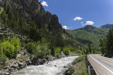
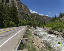
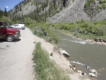
This is a roadside and short section of action. Scout the crux section before putting on using the large turnout downstream of the Penny Hot Springs put-in. There are two other turnouts further downstream that you can peak into the runout but honestly it was all a step and a half easier than the crux, read and runnable, and good to go… though I guess checking for wood wouldn't be a bad idea.
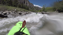
Below put in you only get 100 yards or so of flat water before you enter the constriction and the crux begins. The river is roadblast and unnatural, like a mini North Payette (though I have yet to do that section). At low flows the rocks begin to play a role in the rapid, but the holes lose power and you have more time to maneuver. At 1,200 cfs the river was full and there were no exposed rocks. Lots of waves and holes. The crux is actually super straight forward if you scout, we stayed left through the top and around the middle hole, we then moved center for a wave hole with a tongue through the center which then immediately went over a river wide broken ledge with a tongue just left of center. And then the river opens up and you just pick your way down from there. Around a corner it appears there is something stout, we stayed far left away from the middle where the meat was and punched a small hole. The right also would have been ok. And then it is all mellow from there. It is short, but sweet.
If you wanted to extend it you could paddle the class III section downstream of it. Or, if water is lower, you could scout Meatgrinder Rapid not far upstream and run these two together. Meatgrinder is class V to V+, we only saw it from the road while driving but it has massive gradient, massive rocks, and a lot of power. 1,200 was too high for it for sure.
Mi 0.1-0.4:
- Crux (IV to V-). I really can't imagine this getting class V, it is too tight and not enough features. But, I can imagine at high flows flush drowning for a swim is a legit possibility if you swim. But, perhaps I am wrong, but there wasn't too much to cause a class V boater to swim at these flows (per my extrapolation from the medium flow). As it was, it boated much easier than it looked like it would from the road scout. Scout from the first turnout downstream from put-in. Walk up 100 yards to check out the moves as there are no eddies unless flow is really low. Start left and note the wave hole a third of the way down, we could punch it or avoid it on the left. We then moved back center for the seam in the middle of the next wave hole, this is the feature that also has an undercut on the right, but it was not in play very much at our flow. Immediately below are two offset holes, you could boof or run the seam between them left of center. It then opens up and becomes easier boogie.
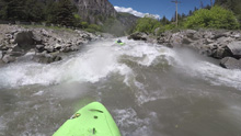
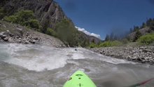
- Lesser Crux (IV to IV+). Around the right bend was another bigger step. We started right and saw what looked like a big ledge on the right further downstream so we moved left across the middle of the rapid below some rocks and above the bigger rocks. We then ran down the right and punched a decent sized hole. The right looked doable in hindsight but was fluffier.
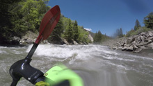
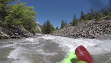
Boogie (III to IV). It gets easier but remains busy...
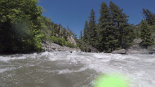
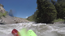
- Islands (III). We followed the main flow as it separated out around an island. The rapid continued but was mellower than the stuff above. At this point we were 3 minutes and 10 seconds in since entering the start of the crux and running without eddies (there weren't any).
Boogie (II to III-). After the Island it mellows out into continuous boogie that felt flat after the action above.
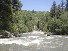
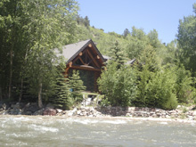
- Avalanche Creek: On the right enters this sizable creek and a dream home that was jaw dropping pretty.
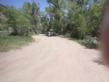
Take-out: From Carbondale, take CO-133 south for 10.1 miles. Look for the dirt short road (like a shoulder, but separated from the road by trees) 100 yards downstream from Avalanche Creek Rd and the bridge over the river.
Put-in: Continue south on CO-133 for 1.7 miles. Stop at the turnouts to scout as you go, the main one being the last. You will then see flat water for the first time and a parking area on the left. Park there. This is Penny Hot Springs and the put-in.
HTML Comment Box is loading comments...
