
Crooked Fork
| Stretch: | Highway 27 to Camp Austin |
| Difficulty: | Class IV to IV+ (2x V-) |
| Distance: | 6.3 miles (+2.0 on the Emory) |
| Flows: | ~4' to 8' (4.8' felt pretty optimal to me) The gauge is on the downstream side of the put-in bridge. It doesn't take a lot of rain to get it going, 1.5 inches, and it holds for a day or two. |
| Gradient: | 80.4 fpm average (not including the flat 1.35 mi paddle in nor the 2.0 on the Emory at the end) |
| Put-in: | Highway 27 |
| Take-out: | Camp Austin Rd on the Emory |
| Shuttle: | 14.6 miles (35 minutes one-way) - There is a hike option people use to one-car shuttle it, the hike apparently takes ~45 minutes |
| Season: | Winter/Spring from rain... |
| Written: | © 2015 |
| Featured in A Wet State #103, A Wet State #126, and A Wet State #136 | |
Norway 2015 - Day 16
After arriving back from Norway late Saturday night, and boating Island Creek and Little Clear Creek on Sunday, I went back to work on Monday. The work was short lived though, and rather than spending the extra hours to ensure I was caught up with my projects happenings while away, I instead packed up the car and left promptly after reaching my 8 hours for the day. With Chad Christopher and Steve Krajewski, off we went for a run that I had tried to do a few times, the Crooked Fork.
The first time I looked at this creek was also the first time I got skunked on Island Creek (low water) and Little Clear Creek (high water). Crooked Fork was at 9 ft which is a rowdy flow apparently. The second time I made plans for Crooked Fork my car died on the way, and instead of kayaking I limped into a mechanic in Oak Ridge and spent the next 4 hours getting my car worked on. This time thankfully, everything went smoothly!
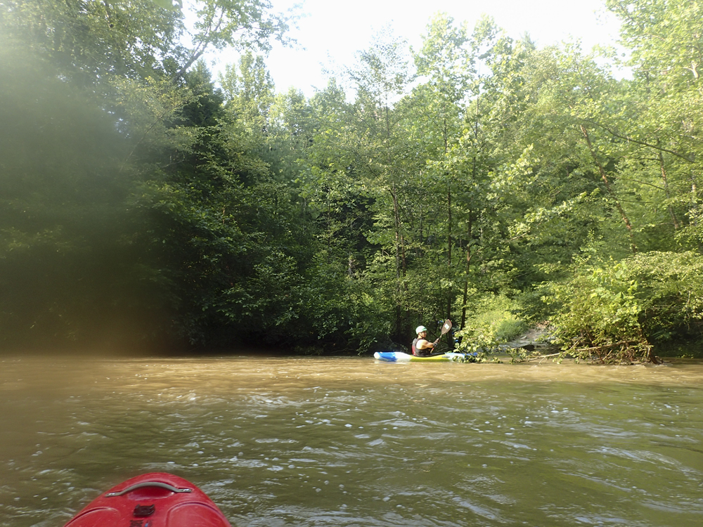
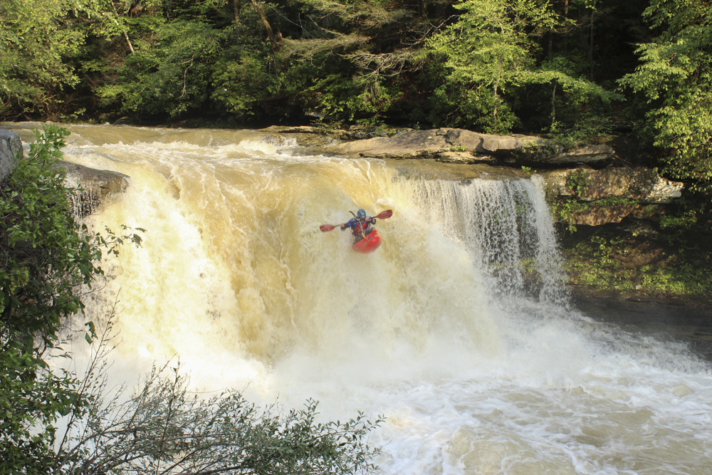
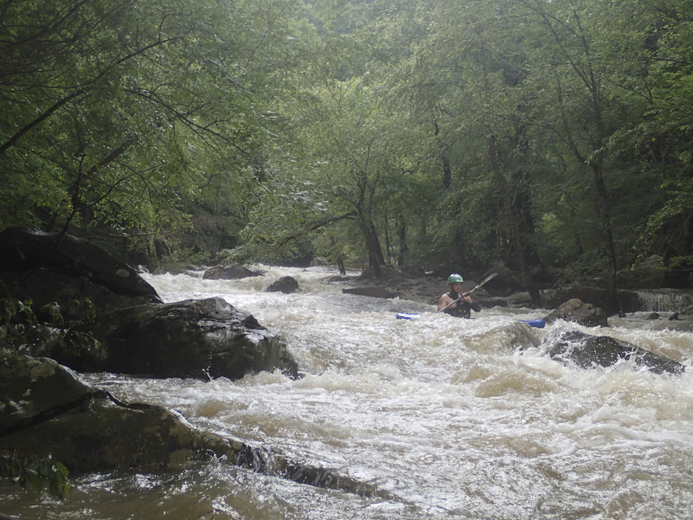
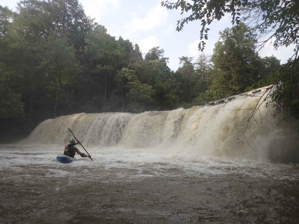
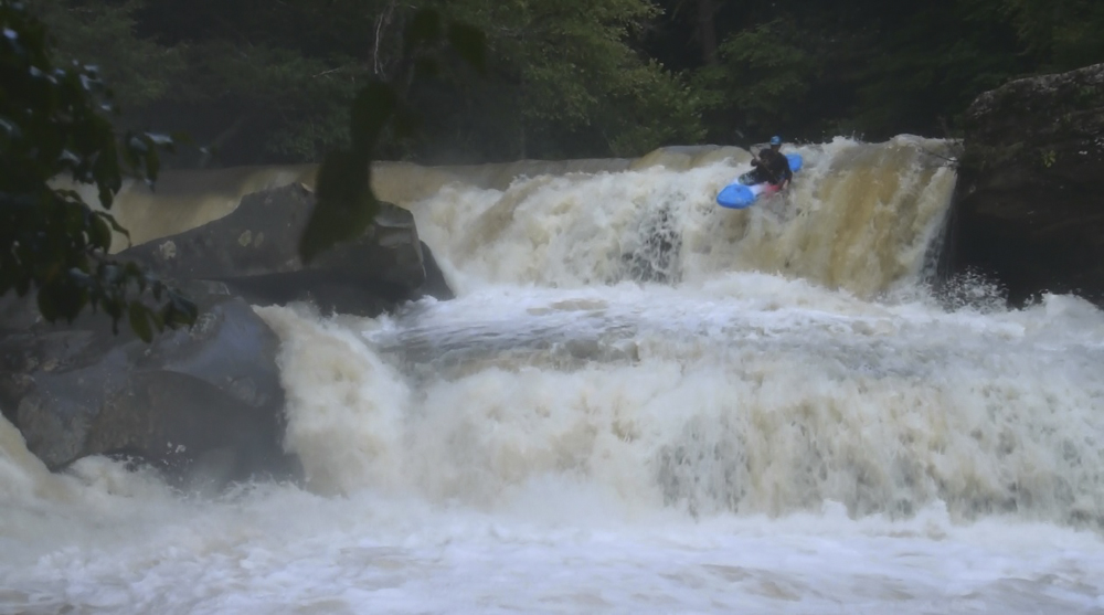
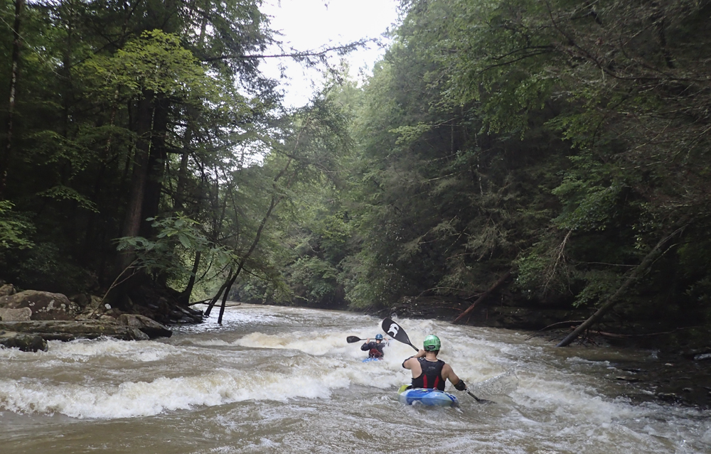
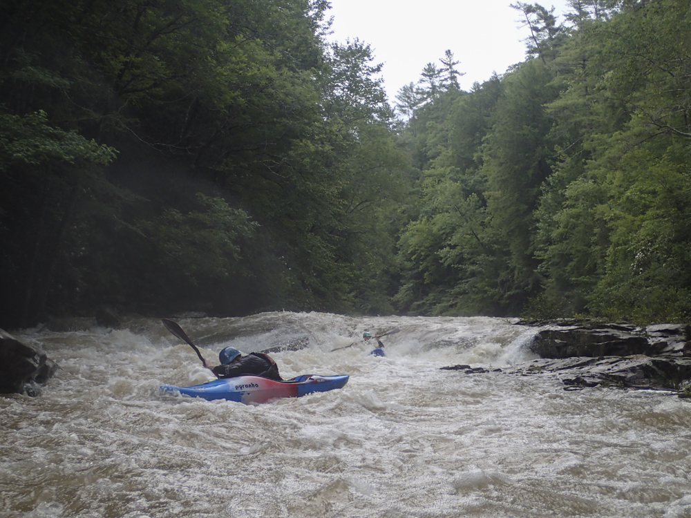
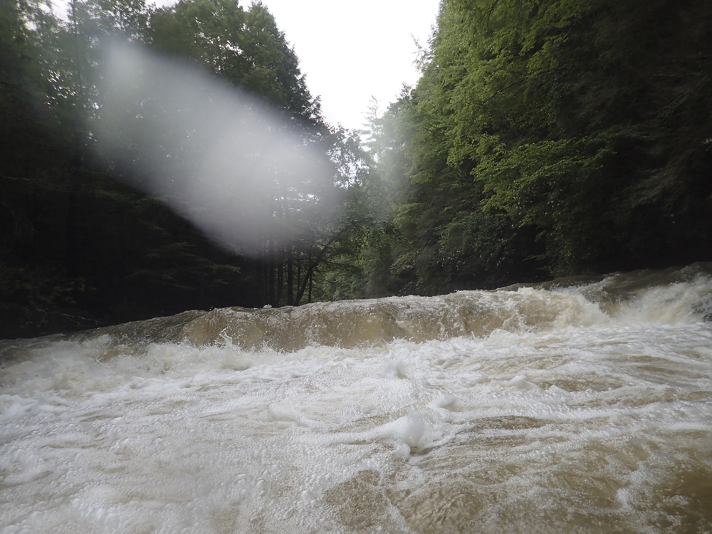
The river starts off slowly, unless you know the access to enter at Lamance, the first 1.35 miles is relatively flat with some class II. Then the river hits Lamance and you get a nice 18 foot falls. Some call it 20, but I really don't think it is, not when it has water in it anyways. I think 15 might even be generous. Anyways, downstream there are several fun rapids which then lead to Upper and Lower Potters falls. These three rapids form the crux of the run and should not be taken overly lightly. Lamance has a thin line between rock slabs. Upper Potters at high flow can develop a mean hole. And Lower Potters also has a thin line to boof onto a lone deep spot on a slab before sliding down and boofing an exit hole. For most, these drops will get the heart going for sure!
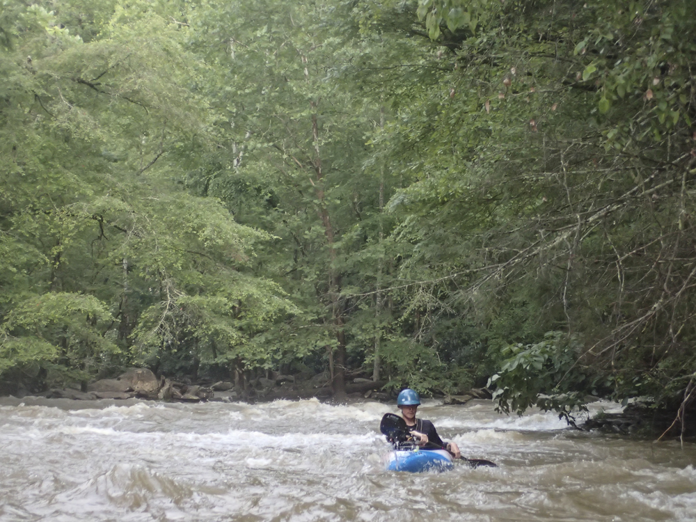
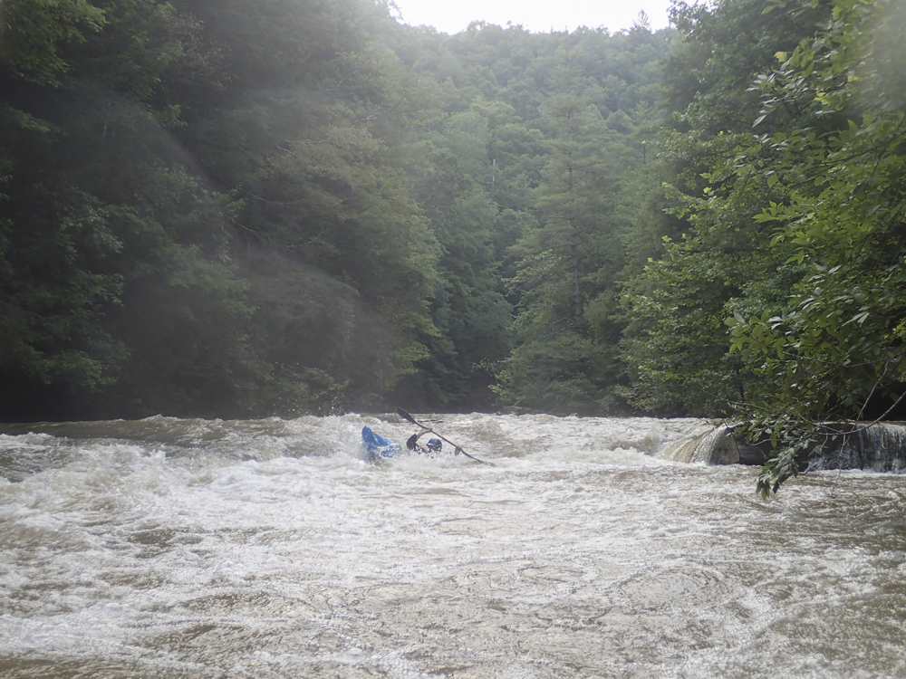
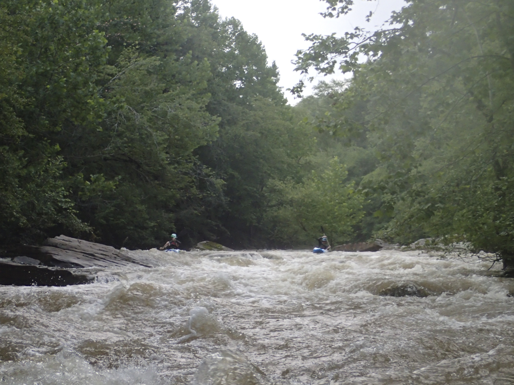
Downstream the river continues its fun nature before it lets up for a mile or two of mellower floating. Then two miles from the confluence with the Emory it once again pics up with several good size rapids that culminate in the final ledge. At high flow I imagine this river wide ledge can be mean! Almost immediately below though the river bends ledge and drops into the Emory where a quick 2 mile paddle gets you to your car.
I had expected that this run was mainly just the falls and the final ledge. After the Little Clear Creek the day before when it turns out I knew of every drop on the run, I expected the same here. Instead, this run was full of fun rapids and slides. I think the one thing that keeps it from being classic is the water quality (you put in at a water treatment facility)... but despite that, there is a loyal following of folks who will go their when it is running.
We had 4.8' or so, and I thought that this was a nice medium flow. Not high, not low. It never felt pushy, the hole just above Lamance was present but totally manageable, and the rocky boulder gardens never felt like we were bashing. I thought it was a pretty ideal flow, especially if you don't know the run.
And there we have it... that is where I will consider the end of that Vacation. 2 weeks in Norway, returning to two days of boating back home. Not bad at all. All told, we got 23 new runs along with 2 additional laps on repeated runs. Not bad for 15 days of boating! Now to plan the next vacation... sadly (or luckily depending on how you look at that) I have 10 months to do it. Sigh....
Update 2017: I got back to this run last night. The flow was 5.7 when we got to put-in to check flow, 6.7 when we got back after setting shuttle, and 8.0 when we finished our run. When inflow the run felt like ~7 ft. I thought this flow was great, but certainly was class IV to V. The hole above Lower Potters is super legit but easy to portage. The boulder gardens between Lamance and Potters are much stouter but also much more padded. And the rest of the run was straight forward but super fun with surf waves everywhere. Great flow for sure.
Last: Norway 2015: Day 15 Afternoon - Little Clear Creek (TN)
Mi 0.0:
- Mostly flat water with occasional class II lets you warm up until Lamance.
- Lamance Falls (IV+). Lamance is a sweet 15-18 foot falls and is a bit challenging. Not a great "first waterfall" like Upper Potters or Baby Falls on the Tellico. This one has a hole at the lip that wants to move you around, and has a shallow landing to either side of the ideal location. To find the ideal landing zone, boof the point of the ledge that forms the falls. We scouted from the right but that was for pictures, to scout the entry hole scouting from the left is more ideal.
Boulder Garden #1 (IV). Just below you enter a fun boulder garden that we ran down the right of center on.
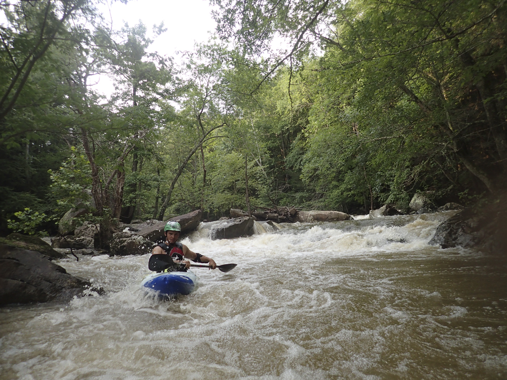
Boulder Garden #2 (IV). Just after the left hand bend you enter another boulder garden that is long. We started center moving left before finishing with the main flow down right of center as I recall.
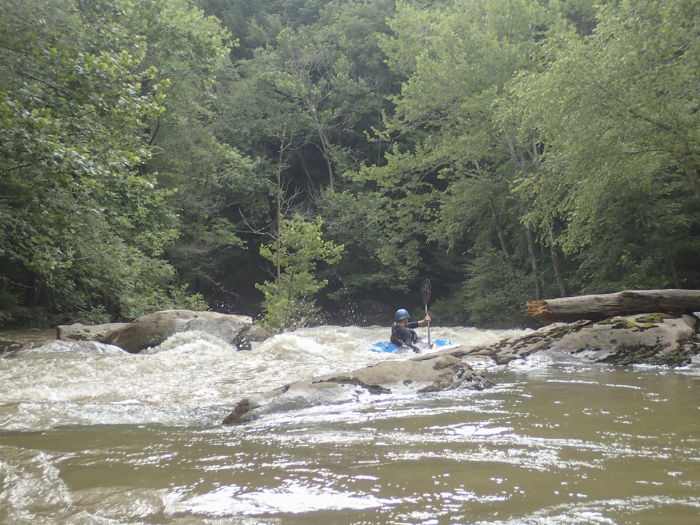
- Upper Potters Falls (IV to V). At normal flows this falls is pretty mindless, an easy and obvious line is down the far left. Though there are other lines as well. At high flow the left line has to be NAILED to avoid a huge hole. The right line is a bit easier at those flows.

Lower Potters Falls (IV+). What a cool drop, doesn't need a whole lot of power or a whole lot of strokes, just needs the right ones at the right time. The line is left of center, boofing the ledge moving back to the right (but still left of center) to boof onto the deep spot of water rather than either rock slab. This then slides out to the exit ledge which although only a few feet tall needs to be hit straight to avoid a surf.
- Below, the river continues with some fun slides before getting a bit easier though still maintain some pace to it.
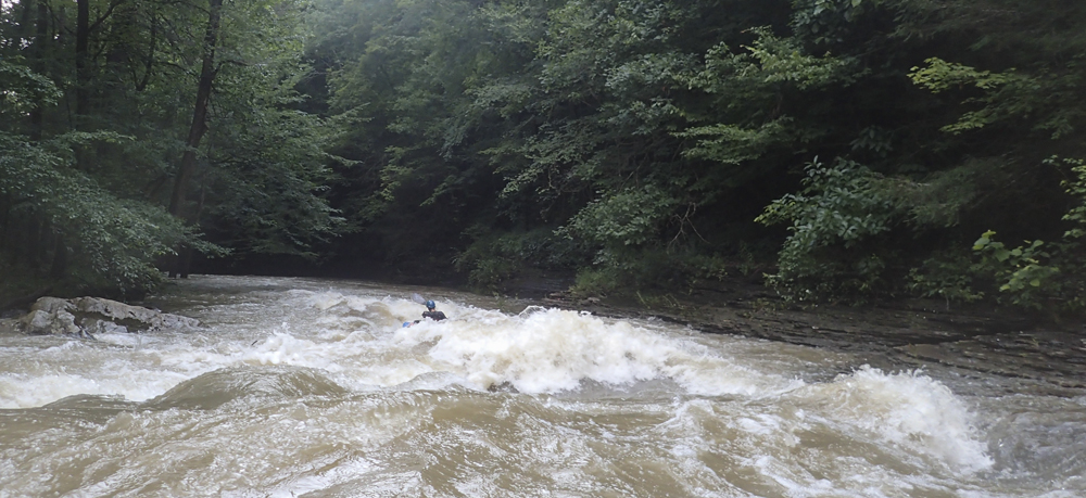
- Things pick back up... but as it has been a month and this is the 22nd new write up I am currently trying to write for the past 1.5 months, I don't remember the details. I do remember this:
- Ledge with Undercut (IV). There was a sneaky ledge that came up in this part, more of a slide around either side of a rock ridge. I chose left and soon was scared as the ridge is undercut and the water pushes into it. Luckily the slide and current allow you to drive left away from it.
- Ledge with Hole (IV). The final ledge is known for swimming people. We ran it basically just left of center. Boof and keep it straight! At high flow I wonder if the far right shore turns into a sneak... perhaps.
- You have one or two class III rapids and then you hit the Emory River. The water will be up if you are boating Crooked Fork so the two miles to take-out goes pretty quick.
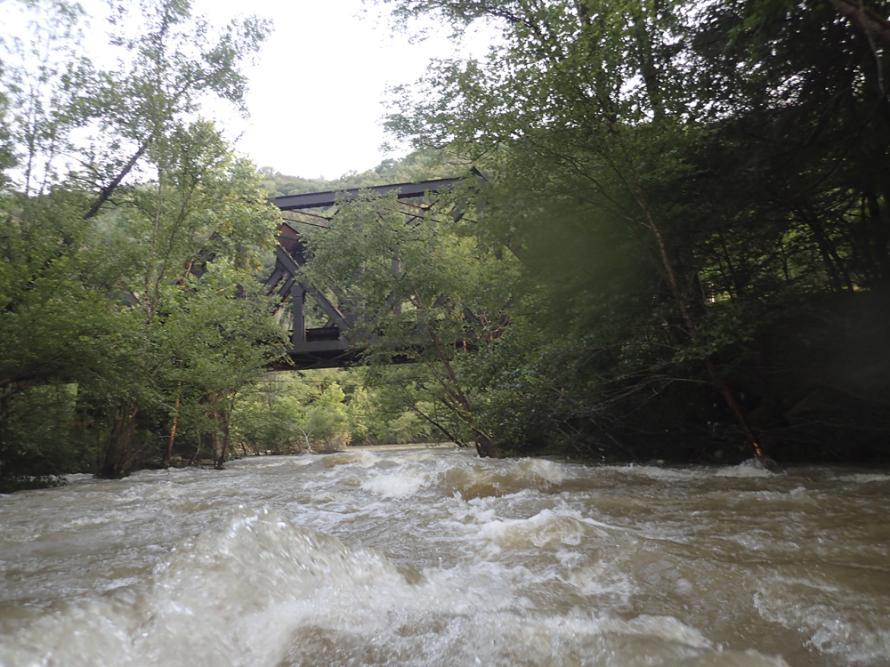
Take-out: Off of Highway 40 in Harriman, take exit 350 for TN-29 toward Harriman / Midtown and turn right onto TN-29. Follow for 2.2 miles and turn right on S. Roane St (TN-61) and follow for 1.6 miles. Cross the Emory and turn left after a few hundred yards on Georgia Ave which quickly turns into TN-29A and then into TN-328. Follow the road along the Emory for 4.2 miles to TN-299 and turn left and quickly turn right on Camp Austin Rd. Continue upriver an additional 5 miles to the train yard on the small dirt road to the left just before Camp Austin Rd crosses the Emory.
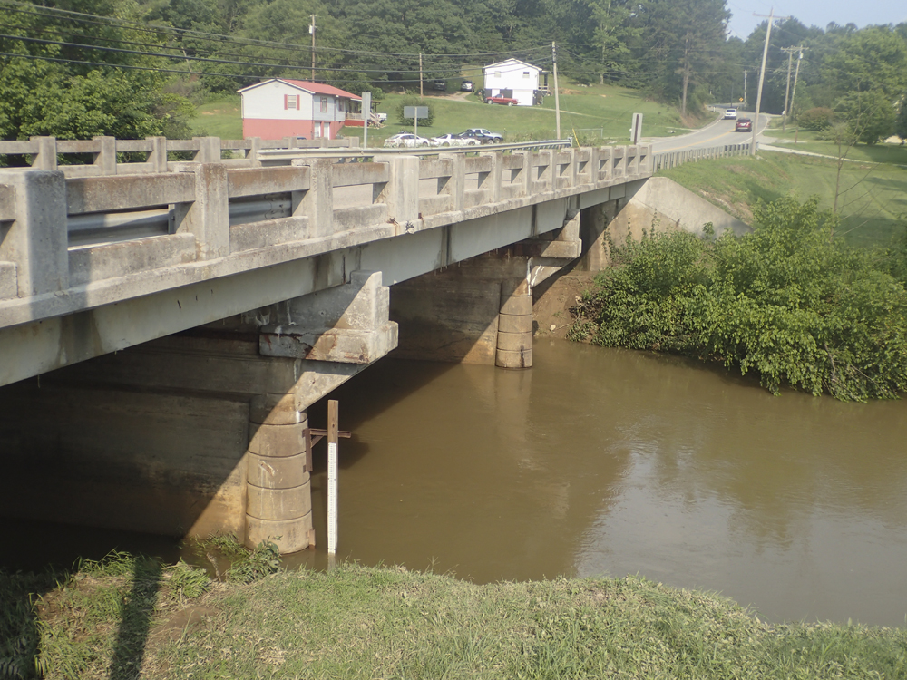
Put-in: There is a hike option, but I don't know the details of that. I think there is also a shortcut... but I also don't know the details. From take-out I went back out to Oakdale and turned left onto TN-328. I followed this for 3.8 miles before turning left onto US-27. Following that for 5.7 miles you will cross the Crooked Fork at the water treatment plant. The gauge is downstream at the bridge.
HTML Comment Box is loading comments...