Clover Creek
| Stretch: | Above Wuksachi Way |
| Difficulty: | Class IV to V |
| Distance: | 0.7 miles |
| Flows: | small (Later season, ~800 to 2,000 in Three Rivers). Current Dreamflows Three Rivers gauge |
| Gradient: | 592 fpm average |
| Put-in: | When you feel like not carrying your boat any further |
| Take-out: | Wuksachi Way |
| Shuttle: | 0 miles. Hike up, ~1 hour |
| Season: | Spring/Summer from snowmelt |
| Written: | © 2014 |
| Featured in A Wet State #88 and in A Wet State's contribution to World Kayak's Video Guide | |
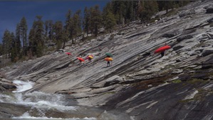
8 years ago I was perusing the Kaweah web page that Bill Pooley maintains. In the picture of a day section (July 2006 to be precise) I find two pictures labeled Clover Creek with some cool granite tea cups. I send a note to my go to boating partners at the time, Mike Ward and Brian Tupper showing them the obscure find and encouraging a trip. Of course... the Kaweah is 4.5 hours away and there is more classic stuff in the area, so each of my four visits prior to this year had other runs on our to do list. But finally, on my second visit of this year (2014) and with our move to TN approaching, we motivated a small group for the obscure day on a very low water granite playground.
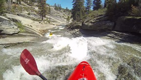
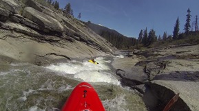
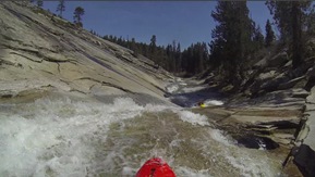
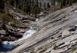
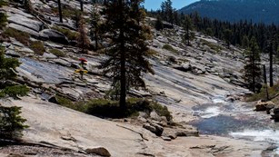
Ironically, the picture I first saw of the run was one of Nathan Hunkapiller... and the night before this trip Nathan was at the same bbq I was at and tried to convince me the run was not worth it and I should instead do Hospital Rock again. I of course stood fast and resisted his recommendation. The water was low, no doubt. Me as a heavy guy felt that more than most. A few low angle sections I literally stopped in due to ground clearance issues. Additionally, the run is a lot of work. You hike a quarter mile from the car to the bottom. Then you hike up as high as you want to go, and at 592 feet per mile you stop not because of lack of granite above, but because you are tired. 0.7 miles is as far as most go. Not too far above it gets a little mankier. The biggest bang for the buck though is simply the bottom 0.25 miles. If you are looking for quick laps that is the way to go. But if you have a day to spend... hike up higher, enjoy the top continuous section as well as the tea cups. This adds one mandatory portage and one potential portage around 60-0, named sarcastically after Hospital Rock's 0-60... which is a much better direction for acceleration to go.
At the low flow I would call it class IV with the tea cups IV+. Set safety on several of the holes throughout the section as they can be sticky, even low. At high flows I imagine this turns into class V quickly as it would be fast and all linked together. Finally, I would also bring some good shoes. The hike is on the granite side wall which at times is quite steep straight back down to the river. 5.10s worked super well. The granite was tacky though so any solid set of shoes should do.
Check out Darin McQuoid's Website for more great photos of the run.
Mi 0.0:
- First Section (IV to IV+). You essentially seal launch into the steepest section of continuous drops. There is one particular two tiered step that has a good size hole in the middle of it. Worth taking a look at and potentially having a rope here. We caught boats at the bottom of the slide. Scout the pot hole immediately below.
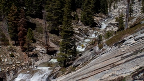
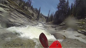
Pot Hole (IV to IV+). So this one was just a class IV drop, drive far right. But if you were to mess it up and fall into the pothole that was backed up by a rock, you would need a rope. Set safety on it as the tea cups are immediately below.
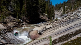
Tea Cups (IV+ to V). At our flow the tea cups weren't bad. The first one is shallow on the left so we ran right. The second one was cleanest at the low flow far left. The third is the hard one and needed to be taken far right as the left side had a crack and descent hole on it. At higher flows I imagine this hole is worth safety. The fourth was straight forward on the right into a long slide that we caught at the bottom of. The next rapid is commonly portaged.
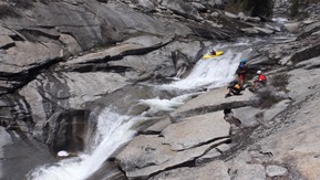
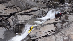
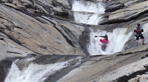
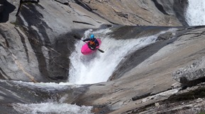
60 to 0 (IV+). So it isn't a hard rapid... but you will take a big hit off of the left wall. We portaged and seal launched just below.
Slides (IV). Some sweet slides lead down to the pool above the portage.
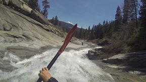
Portage (?). I honestly didn't look at the rapid. It was the one spot not open granite, amongst willows and trees and boulders. I was told it was a walk so I walked and seal launched in below.
Final Slides (IV to V-). So I have seen video of this with a river full of water and dang it looks like fun. From take-out you only see the last half of the slide. They all go just fine. Follow the water and arrive at the pool at the bottom!
Take-out: From Three Rivers, drive up Highway 198 for 28.2 miles into Sequoia National Park ($20 for a weekend pass). You will eventually cross the Marble Fork (for a second time, this time at the top) and soon thereafter cross Clover Creek. A few hundred yards later turn right on Waksachi Way. Continue straight, don't drop down to the structure, just continue straight for 1 mile until it dead ends in a large parking lot at the bottom of the hill. The trail is on the left which leads to the bottom of the slides. Cross the creek and hike up.
HTML Comment Box is loading comments...
