Clear Creek (Kermits/Upper)
| Stretch: | Two Bears Tap and Grill to Big Easy Trailhead |
| Difficulty: | Class IV |
| Distance: | 5.85 miles |
| Flows: | 200 to ~1,500 cfs. USGS Clear Creek near Lawson gauge |
| Gradient: | 80 fpm average (119 fpm from Mi 0.9 to 2.6) |
| Put-in: | Shoulder at the US-6 and I-70 junction near Two Bears Tap and Grill (formally Kermit's Bar) |
| Take-out: | Several options, Big Easy Trailhead is the last |
| Shuttle: | 5.2 miles, (10 minutes one-way) |
| Season: | Spring off snowmelt |
| Written: | © 2021 |
| Featured in Video A Wet State #159 | |
-
Colorado Road Trip 2021: Day 14 Morning
Our final day was a rather nice one. Boating from this section, into Black Rock, through Lower, and down into town... it was a great way to end the trip. To add to the pleasure, we got to see a friend of ours from our California days (Nick Abrams) who now lives in Colorado. This was fortuitous as I don't think I properly gave my respects to this river and a few spots would have snuck up on our, and a few others would have required long scouts. Having Nick along saved a lot of time plus reduced the stress level a good bit!
So its funny, Nick had a dentist appointment that morning and was going to be an hour behind us. So he opted to meet us at the Black Rock put-in. He also admitted he had never done this section. I was surprised by this and immediately wondered if this section was no good then. I think it is just a case where the easier fix for the class V boater is Black Rock and thus our friend, and may others don't bother venturing up here. But man, I enjoyed this section. The rapids were a great warm up for Black Rock and Clear Creek in general. Getting into a grove with the continuous whitewater, punching holes, reading and running the river, getting peaks from the top of the rapid and peaks for the wave tops, it is not something we are used to coming from California and Tennessee.
The run starts out with two pool and drop style rapids. These are not the norm. Before long, the continuous rapids begin and you are left holding on and sorting it out as you go. Diane and I got out once at a rapid that we just couldn't see over the lip, well we couldn't get close enough to the lip to see over it, and thus opted to keep it safe and Diane popped out for a quick scout. It proved mellow enough and we continued on. The last bit of the section the river mellows out, but the scenery gets super nice, nicer than it looks from google earth, and nicer than I expected. I should have taken some good camera pics of the scenery, but we were on a time constraint so I did not.
Anyways, we had 860 cfs dropping to 800 when we arrived in Golden 3 hours later. I thought this was a great level. No rocks, a smidge pushy, but obviously not flooded. Just good quality fun in the class IV range. Note, I think I give things in Colorado an extra half rating over what locals do, just because I am so unaccustomed to the continuous nature. I think about the class III+/IV- boater running Chamberlain Falls at low flow and think about how ill-equipped they would be running this section and how bad the resulting swims would be.
Note: The action on this run is pretty darn continuous, so I can't give a rapid by rapid after a single lap, but instead just a general lay of the land. I feel like the action being so continuous makes the 1.7 mile crux of the run from 0.9-2.6 class IV overall at 800 cfs because a swim would be a long affair, and being upside down could also be a painful experience. Perhaps lower it is more straight forward.
Mi 0.15:
- Upper Beaver Falls (III to III+). The first rapid packs a punch but is easily scoutable from the road just downstream from putting on. We went left of center and punched the curler to drop into the hole below. I could see this giving people issues due to the lack of warm up.
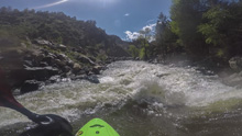
- Lower Beaver Falls (III- to III). Much easier than the upper falls, this one had a thread the needle line center moving left, between two flakes. I think right would have also worked.
- Action Picks Up (III to III+). The boogie begins in earnest and is more or less continuous for the next 1.7 miles.
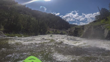
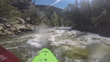
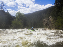
- Bridge: You cross under a bridge, stay on your toes as you quickly get to the biggest rapid of the run.
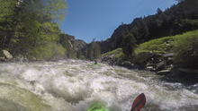
- Double Knife (IV). After a lead in boogie section, I eddied out left and could not see the line from the boat, so Diane hopped out on the right to take a quick look. Then a group of rafts came through and we could see them run it center moving left to avoid a rock ledge at the top right, and then back right to get off the wall and the punchable holes on the wall.
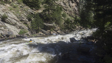
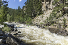
Hell's Half Mile (III to IV-). Immediately below you get into a busy boogie section, the hardest boogie of the run. The road goes into a tunnel here which means the scenery is a nice canyon and away from the road. The action continues even after the road comes back.
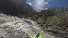
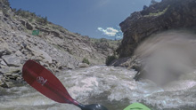
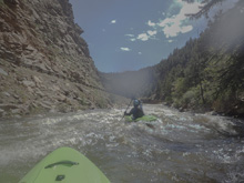
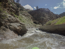
- Bridge and Tunnel: The road crosses the river and goes into a tunnel, once again leaving the river in isolation.
- Mellows Out (II to III-). The boogie mellows out in a large way before the road rejoins the river and stays at a mellower, but still continuous pace to the take-outs.
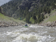
- Junction Bridge: A large bridge marks the junction of US-6 and CO-119.
- Optional Take-out: Shoulder access take-out. (I did not use, I assume this is usable, use your judgement)
- Optional Take-out: Shoulder access take-out. (I did not use, I assume this is usable, use your judgement)
- Optional Take-out: Mayhem Gulch Trailhead provides parking access for the river. This is probably the best take-out option as the shore is easily accessible and eddies plentiful.
- Last Take-out: Big Easy Trailhead provides parking access for the river. However, as a take-out this location isn't super ideal as the roadblast shore is steep and eddies are not plentiful. We were able to stop and get out at 800 cfs to wait for our friend who was meeting us here, higher would be more challenging.
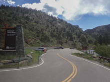
Take-out: From Golden, take US-6 up the Clear Creek canyon. After 9.1 miles you will see Big Easy Trailhead's parking area on the left. This is the lower take-out. If you want to use upriver take-outs, continue driving up US-6.
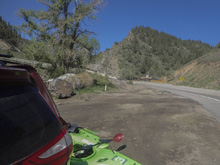
Put-in: From Big Easy Trailhead, continue up US-6. After 2.3 miles, turn left, crossing the river to stay on US-6. Continue another 2.8 miles. Just before the I-70 onramp, park on the left along the river.
HTML Comment Box is loading comments...
