Clavey (Upper)
| Stretch: | 1N04 Bridge to 1N01 Bridge |
| Difficulty: | Class IV to V |
| Distance: | 8.5 miles |
| Flows: | 450 to 1,000 cfs. Dreamflows gauge |
| Gradient: | 125 fpm average (first mile is 215 fpm) |
| Put-in: | 1N04 Bridge |
| Take-out: | 1N01 Bridge |
| Shuttle: | 18 miles (40 minutes one-way, some dirt, CRV ok) |
| Season: | Spring from snowmelt |
| Written: | © 2010 |
| Featured in the Mayor of Mann's Creekvideo | |
David Maurier first mentioned this run to me several years ago after his first run down the Upper and Lower runs. He stated, "You and Diane would love the Upper run, it I like Cherry Creek. Lots of Fun." Or something to that affect at least. However, with stories of wildly inaccurate gauge estimates and a notoriously heinous shuttle, I never got motivated to set out on the mission.
This year everything changed though. In one of my conversations with Shackleton he mentioned that a live gauge was just posted on Dreamflows. Nearly instantly the run dropped onto my radar. On a side note, this sort mentality shows just how I would not have been cut out to be a kayaker back in the 80s when folks would get skunked all the time by high or low flows. Now it seems we expect to have perfect flows every time we drive to a river, and get upset when we have anything but perfect flows. And if God forbid, Dreamsflows has an estimate that states "70% chance that the flow is between 400 and 600 cfs" and we have 350 when we show up, we get pissed and complain. It is just interesting, sorry for the tangent about me as a lazy kayaker who is ungrateful for Dreamflows (just kidding Chris). So as I was saying, now that I knew that we had flows, I was willing to make the drive and motivated a group to join me.
Speaking of motivating a group, a useful method that I have found in motivating a group of people to boat something that has historically had a bit of a stigma to it is invite people who have no idea what the river is or any of the concerns over the logistics. If they are from out of state, say North Carolina or Germany, this is made much easier.
As the weekend progressed it looked like flows were going to drop from the rain spike to a runnable level. With optimism I organized my North Carolina and German as well as arranging a second car to save driving two cars from Sacramento. The plan was to do the North Fork of the Tuolumne on Friday and then drive to the Upper Clavey take-out that night. Foolishly looking at google earth, the computer (which we know are never wrong) told me the quickest way from the NFT put-in to the Clavey take-out was to drive the dirt roads. This ended up taking 1.5 hours and likely blew the shocks in Diane's car (though for the record the CRV did make it!). In hindsight the quicker way would have been to drive the 17 miles or so on perfectly nice paved road to the Upper Clavey put-in and then drive 6 more miles on nice pavement, followed by 3 miles on nice gravel, ending with only 3 miles on a decent dirt road, a route that would have taken less than an hour (or so) and would have provided much less abuse than 20 miles on dirt roads that occasionally bordered on crap.
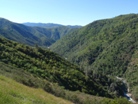
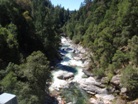
Anyways, once we got on the river we were greeted with some great scenery and some equally great rapids. This starts off a bit rough with a portage or two in the first straight-away but soon turns into really great read and run class III-IV with an occasional IV+ for the next several miles. Once you begin to see some red granite (as opposed to the black granite gorges that you have been running) you will notice the gradient gets steeper and the rapids get harder. In the final two miles are numerous great class IV+, and V-. Although only one or two of the rapids deserves a class V rating on there own, there are several sections with only eddies between drops adding significant pressure and consequence to the otherwise class IV or IV+ moves. We had 650 cfs at take-out and I thought this flow was ideal. Some of the rapids have shallower lead-ins but finish in large holes that must be punched or boofed over. With less water the lead-ins may become more tedious while at higher water the holes may become stickier. I would think at flows between 500 and 800 would be the best window.
So to conclude. This run took us 3 hours to run which only included a handful of scouts, several of which were from the last minute eddy above the crux of the harder rapids. The scenery was really great and the rapids will leave you smiling. While the Stanley/Holbek write-up states that with "5 or 6 portages you can take the class V bite out of the river making it ok for any competent class IV boater," I think I would upgrade it to "any competent class IV+ boater" as the size of the holes and proximity of the next hole just seem too much in my mind for a class IV boater. I think now that this run has a gauge on it, and since the shuttle really isn't as bad as the legends have made it out to seem, that this run will begin to get a lot of attention. And it deserves it.
Also. some random facts. Did you know that the Clavey River is the longest undammed river in the state? Also did you know that The Clavey ranked third, of all Sierra streams, in the prestigious Sierra Nevada Ecosystem Project's (SNEP, 1996) Index of Biotic Integrity, receiving a score of 92 out of 100 behind only Mill and Deer Creeks. Also, the once planned Clavey River Dam would have been the 10th highest in the nation providing power to Turloch and surrounding cities. Finally, although being recommended for inclusion in the Wild and Scenic Act by the US Forest Service in 1996 and the Secretary of Agriculture in 1998, Congress has yet to add this pristine river into guaranteed Federal protection.
Mi 0:
- Depending on where you find a way down to the river, you may or may not get the first two rapids.
Under the Bridge (IV). A double boof with a larger than expected hole in the middle. We ran down the right.
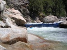
Lead In (IV). I actually just snuck my way down the shallow right side to avoid any possibility of getting swept into the large rapid below.
Portage #1 (V+). It goes. There was a line on the left involving a few steep drops into a very large caved in hole whose boil was 20 feet downstream. With more water you may be able to take the small boof sneak on the right. We portaged on the right and put in at the base of the right side boof.
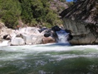
Down Mess This One Up (IV to IV+). I don't remember the details of this rapid other than it went down the left I believe and had a good size hole. We then caught an eddy on the left before realizing the next rapid was huge.
Portage #2? (V to V+). By far the biggest rapid on the run that commonly gets run. This rapid has rocks everywhere and looked cleanest down the left. Jonas believed in the line and nailed it. There is a small eddy before the last tier which has a zig-zag with a good size undercut in play on the left at the bottom.
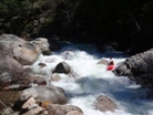
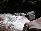
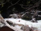
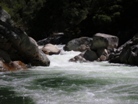
- You are now threw the first half mile. Things get much lower stress for the next 5 miles. Fun class III and IV continue with an occasional IV+.
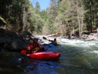

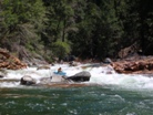
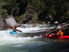
Double Drop (IV to IV+). Two good size holes, it would be nice to know that the second one was there before the last second. Oh well, it goes, just get your nose up.
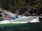
More fun III-IV continues. At mile 2.2 Reed Creek comes in dumping another 100-300 cfs. Somehow, I still managed to miss this large tributary.
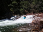

- Left Slot (III to IV). A steep horizon ends up being an easy ramp into a small hole.
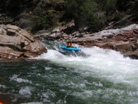
The gorges steepen around you but the rapids remain class III-IV. Eventually you begin seeing reddish rocks (as opposed to the black granite) signaling the start of the harder few miles. It stays steep the rest of the way until just before take-out.
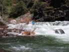
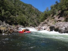
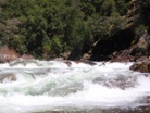
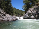
- Down the Right (IV+ to V). I just remember the bottom smearing up onto a big curler for a boof over a large pour over hole. This rapid will feel much bigger than the what you have been running for the past several miles. We took lunch just downstream on the right on some warm rocks.
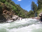
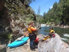
- Zig-Zag (IV to IV+). Two good size curlers, the last should be fought through heading right as the left ends in a pour over which gave one of us a good surf.
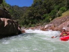
3-Tiers (IV+ to V). At our flows all the holes were easily punchable but I can imagine that with more water the boof entry hole would be very sticky. Also, the third hole was super sticky every but far left and far right even at our flow. We ran it down the far left.
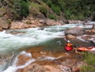
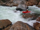
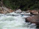

Boof Section #1 (IV+ to V). None of the moves are class V, but stout holes and small eddies between the sections require some nerve and a good boof. Not the place for a swim.
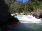
Boof Section #2 (IV+ to V). Another section of boofs. The largest set was a double drop which appeared to have a tongue down both drops. Instead the first tongue just subbed you deep into a seam flushing each of us down the second tongue in huge stern skirts.
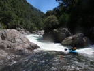

- Not Big But Oh So Fun (IV+). This one had more bark than bite, but dropping through big holes and large waves all on the fly was such a blast. This is certainly one of the better rapids on the run even if it did lack some individualistic character.
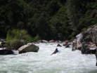
Boof the Plate (IV+ to V). A good size lead in with rocks in all the wrong places to prevent you from getting a straight shot at the boof in the crux of the drop. However you can (we went down the right) get to the boof in the middle over the large hole and stay middle down the ramp into the good size hole below. A good drop for sure. Scout from the left, fairly easy portage if you are so inclined.
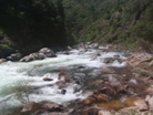
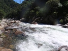
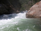
A few more read and run class III to IV.
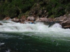
The Ledge (V). The lead in was a good class Iv to IV+ rock and hole dodging affair. At the end of this dodging we realized the bottom ledge was bigger than our brief scout from the top led us to believe and we narrowly caught eddies at the lip. Upon further scouting we found a 8 to 10 foot ledge with a bad pocket on the left and a depressed pocket on the right. Jonas decided to run onto the jet of water flushing out between the two. Looked easy though so did the walk on the left.
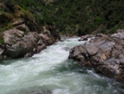

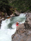
Cut Across (IV+). Starting on the right we cut across the river below the first set of ledges and then finished on the left through two more good sized holes.
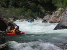
- The Dieter King Drop (V+). I don't know if anyone else has run this drop, maybe folks have. I was told Dieter ran it with more water. At our flow the center rock formed a large pillow and dropped most of the water down two cracks on either side of it. The photos from below make it look good to go, but don't be fooled.
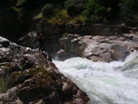
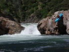
One or two more class III-IV drops and you get to take out.
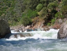
Take-out: Regardless from where you are coming in from, I would go via the put-in rather than direct to take-out. However, if you want to have some fun on dirt roads here is the way. 1) From the town of Tuolumne, take Buchannan Rd out of town towards Cherry Creek. After a mile or two you will see a bridge on the right that cross the North Fork of the Tuolumne. Take this road (1N01) for 5.6 miles and turn left on 2N11. Follow this road up a small valley with a house (suspected meth lab). On the other side of the small valley the road will turn back sharply to the left, stay on the main road. 2.1 miles after that sharp turn you will come to a 4 way intersection, on the right will be 1N49 which will rise steeply and is paved for 50 feet. In 2.9 miles you will get to another 4 way intersection, turn left on 1N01 again and follow this down to the river. It will be another 15 minutes or so of driving from that point. In all this method took 1.5 hours or so. Also, just to note, the CRV made it, though barely.
The other method for getting to takeout would from the town of Tuolumne, drive to put-in, and then drive to take-out. This way is much easier on the car and shorter as well. 2) From the town of Tuolumne take Buchannan street. Instead of crossing the North Fork of the Tuolumne at the first bridge as stated above, keep driving on the nicely paved 1N04. From there, just stay on the nicely paved 1N04 the whole 17 miles. Really quick drive of about a half hour. From there, cross the Clavey and drive another 3.6 miles. Just after Reed Creek take a right on the paved road 3N01 (look at a map if you want to come in from Groveland, this is where you pop out from the Cherry Creek put-in road). After 5.0 miles turn right on the gravel/less paved 1N08 road. After 1.6 miles take a slight right on 1N01. I think it was at this time the road turned to dirt. Stay on this road for 7 miles until you drop down to the bridge over the river. The best river access in on the river left where a small trail leads up.
Whichever way you go, it is worth taking a look at google maps or something to familiarize yourself with the route. Please don't only take this description.
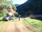
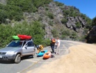
Put-in: Take 1N01 up the east side of the river for 7 miles. Turn left on 1N08 and the road becomes paved, follow for 1.6 miles. Take a left on 3N01 which is paved and follow until you come to a T at which time take a left on the very well paved road 1N04. Once at put-in, we took a irrigation spillway under the bridge on downstream river left and followed the steep ravine down to the river.


HTML Comment Box is loading comments...
