
Citico Creek (Upper)
| Stretch: | South Fork Citico Trailhead down to 2nd Bridge |
| Difficulty: | Class III to IV |
| Distance: | 2.65 miles |
| Flows: | 0" to 24" over the low water bridge. Look for Tellico to be over 4'. USGS's Tellico gauge |
| Gradient: | 140 fpm average |
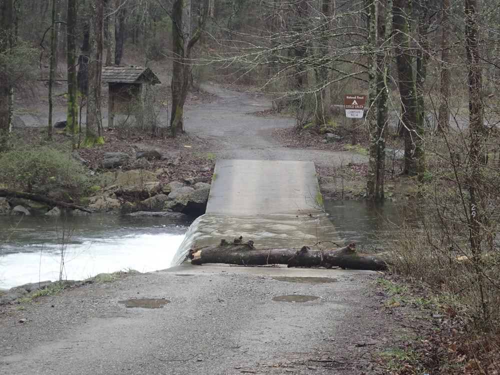
| Put-in: | Downstream of low water bridge, near the South Fork Citico Trailhead |
| Take-out: | At the 2nd Bridge below put-in on Indian Boundary Rd. |
| Shuttle: | 2.65 miles, (5 minutes one-way, potholed dirt road) |
| Season: | Fall, Winter, and Spring from rain |
| Written: | © 2019 |
| Featured in A Wet State #150 | |
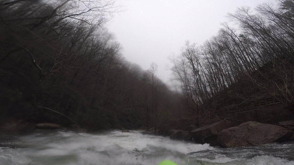
Diane had this day off, which meant I was going to try to fit as much in as possible. The rain was hitting hard everywhere, and everywhere had been getting rain for the prior several days. Because of this, the ~2" of rain in the prior 24 hrs that the Citico area had received was more than enough to get it running and to keep it runnable some 18 hrs later.
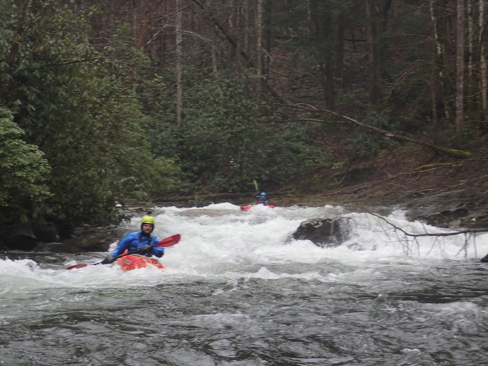
Joining us that day was Matt, and on our second lap, Jack. Diane slept in the car, and when we hit the pothole infested dirt road up the river, began to get sick and arrived at take-out puking. I had developed a bad back spasm the night before, and would be taking pain pills... which later, on an empty stomach, also resulted in me getting sick. It was not our finest day!
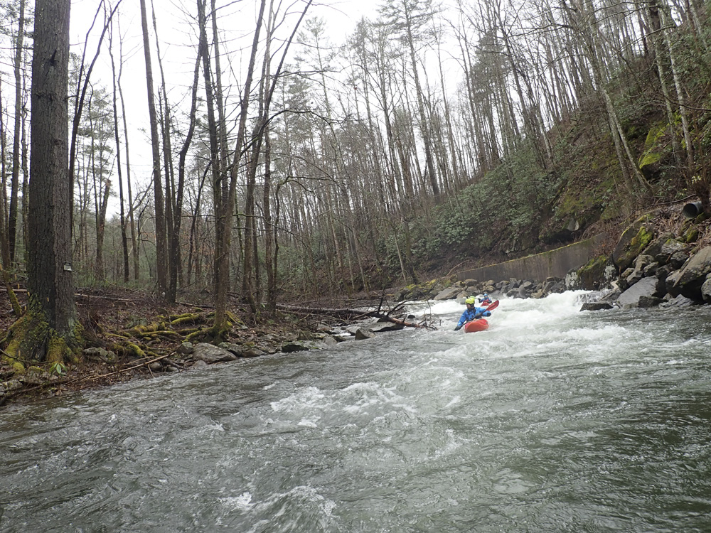
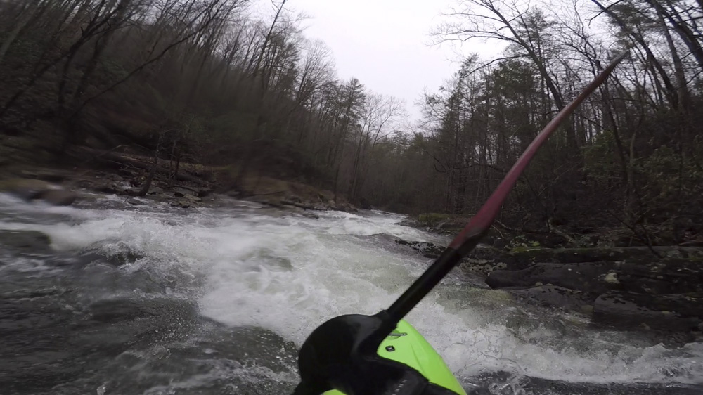
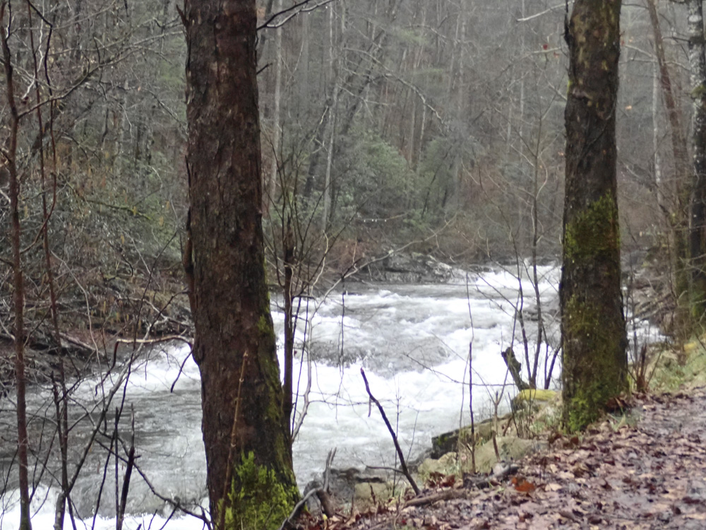
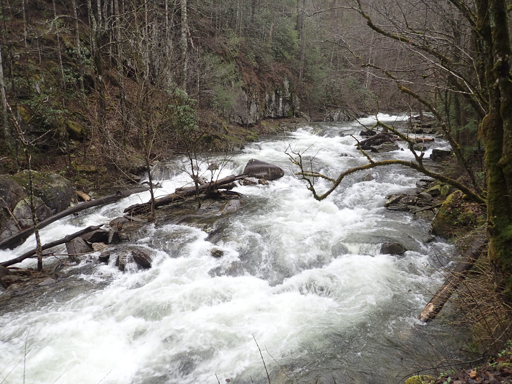
This run is roadside for almost its entirety. It does pull away a time or two, but the nature of the rapids remains the same in those sections. The nature is a nice class III to IV, with one standout rapid, "Pigs in Space" in the normal section from the low water bridge to Doublecamp Creek. We went another mile downstream to get another nice slide as well as the Dam rapid... since the dam was removed in 2015 it is now a nice rapid over a fluffy hole. The run goes fast, since the scouting was done before we put on. So in no time, we were back at take-out and loading up for a second lap.
I think if I was only planning to run this creek this day. I would continue on down a few more miles as the class II+ whitewater continued, and an occasionally class III to IV drop was present. It just wasn't at the same pace as the classic section. Instead, after we finished our second lap, we headed over to Bald River for a lap on that.
Citico had maybe 4 inches of water going over the low water bridge. Water even with it is low, 2 feet over it is high. I though our flow was a nice enough medium side of low flow. Made the rapids mellow enough, and most of the trip rocks were covered. The nature of the rock is not great, not smooth. It is because of this, it is nicknamed "Shitico" at low water. So I would caution against going there and trying to sneak in a low water run. If water is high, you could always take a look at Doublecamp Creek which flows into the traditional take-out. For reference, Tellico was 4.5' and dropping our day.
Mi 0.0:
- Boogie (III-). Just one or two easy rapids to get warmed up on...
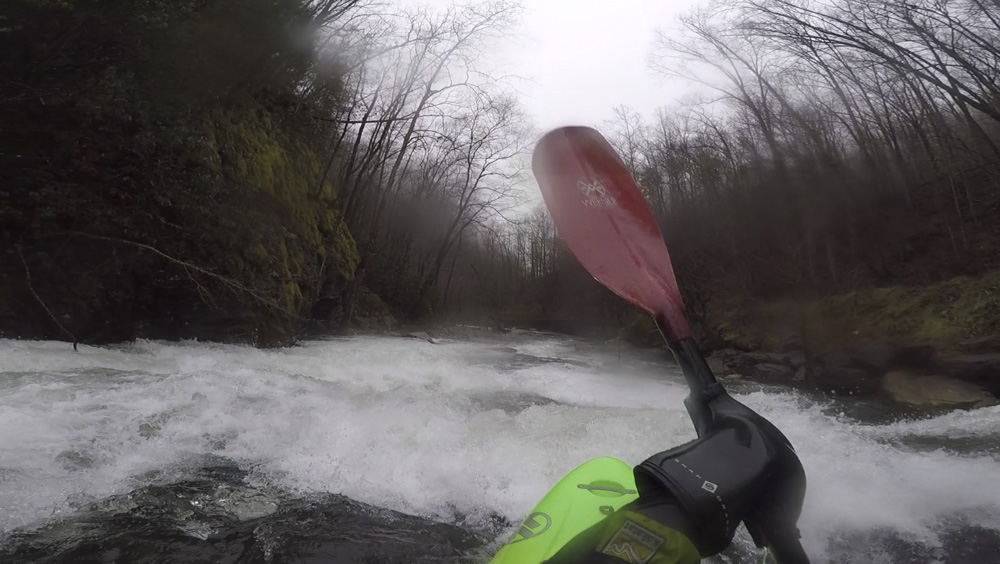
- Ledges (III to IV). The first rapid is full of ledges that can pack a punch as the flow gets higher. You can see it from the road, so perhaps if you want to scout it just do it from the road before hand. We started generally right in a small seaming cross current which leads to a small hole and a small pool. We then ran the exit ledge on the right. This then led to a nice slide immediately below that we ran down the middle.
Boogie (III-). The boogie here tends to be III- variety...
- Corner Rapid (III to IV-). This rapid happens as the river bends left and has two parts. A large rock forms the left bank, it is easiest to boof directly next to it, or you can run down the right shore, thought it is harder to get to. This leads to an exit ledge which we ran down the left. Our day it had an extra hazard as a tree was on the right shore at the exit ledge, extending into the flow.
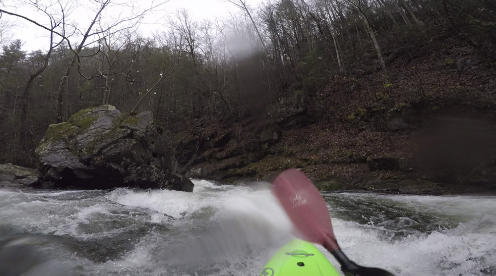
- Boof! (III-). This rapid was straight forward, but had a sick boof on the right shore. It is at a rock fence, go far right and boof the shore for a good time.
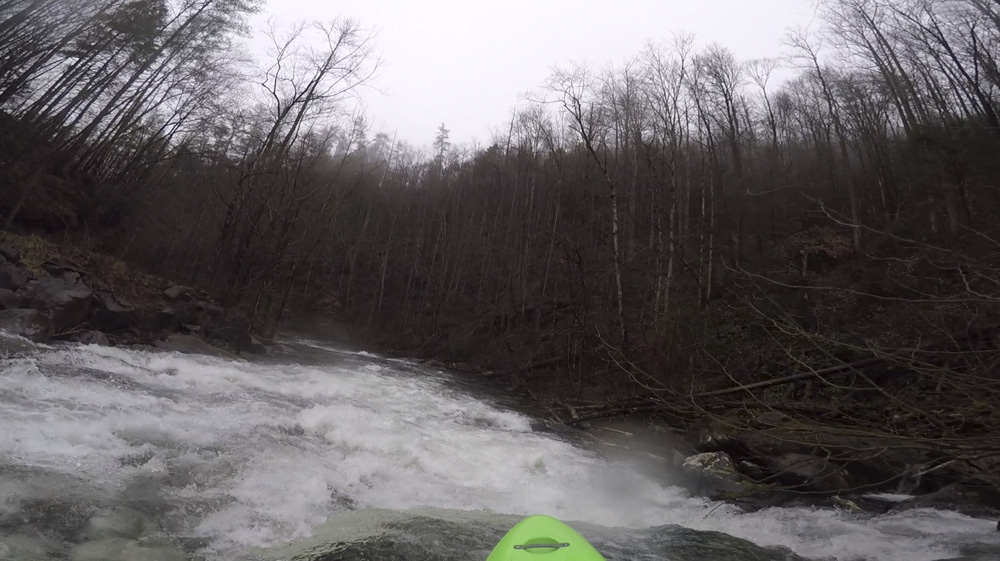
Road Pulls Away (II+ to III-). As the road pulls away out of site there is some nice boogie.
- Roadside Again (III). As the river comes back to the road, there is a small section of small slides that leads to a 90 degree right turn, on the turn is a junky rapid. Normally I think you would go left, but there was wood our day. So we went down the middle, threading the needle between rocks.
- Step Down (III+). A long section of nice boogie leads to a slide that steps down off a ledge. We boofed off the ledge far right, though other lines exist basically anywhere. Downstream one more small rapid occurs as the river bends left, and then you are at the main event of the day.
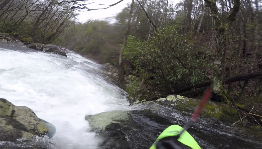
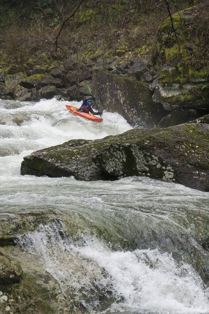
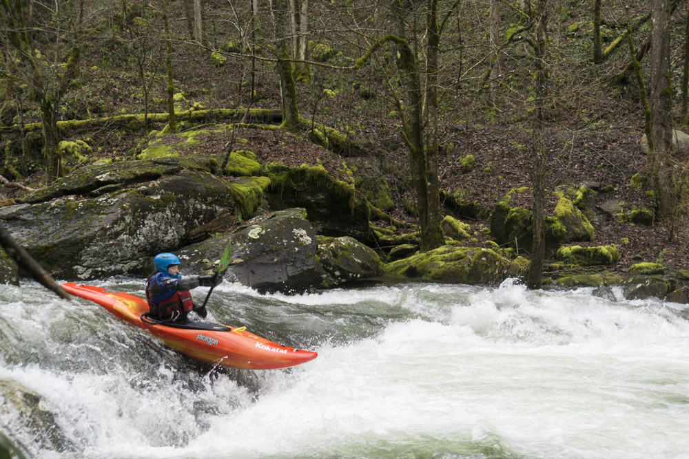
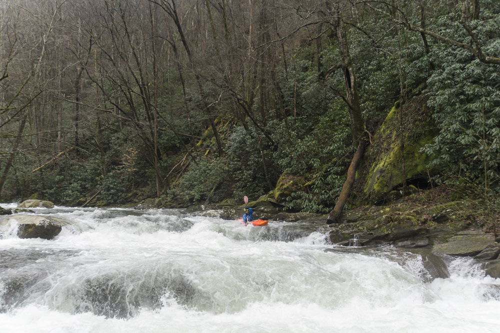
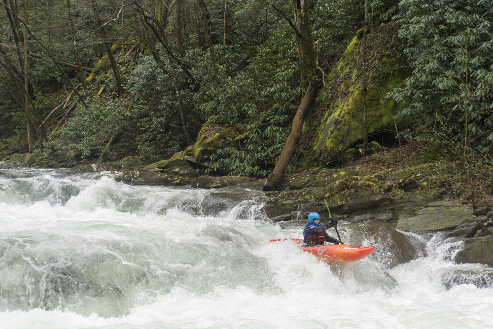
- Pigs in Space (IV). At low and medium flows this rapid is fine, at higher flows a few of the holes get some meat to them. We scouted from the road on the way up. We entered down the left and hugged the left shore, boofing the first ledge which was more of a ramp then a straight ledge. This then snakes around a quick corner and drops you over a sticky ledge. At our flow this ledge was fine anywhere as long as you were straight and took a stroke. For a safer bet though, far right was good. The exit of the rapid was one of two slots, either was fine.. This then led to a nice section of boogie as the runout before it tapered out to class II.
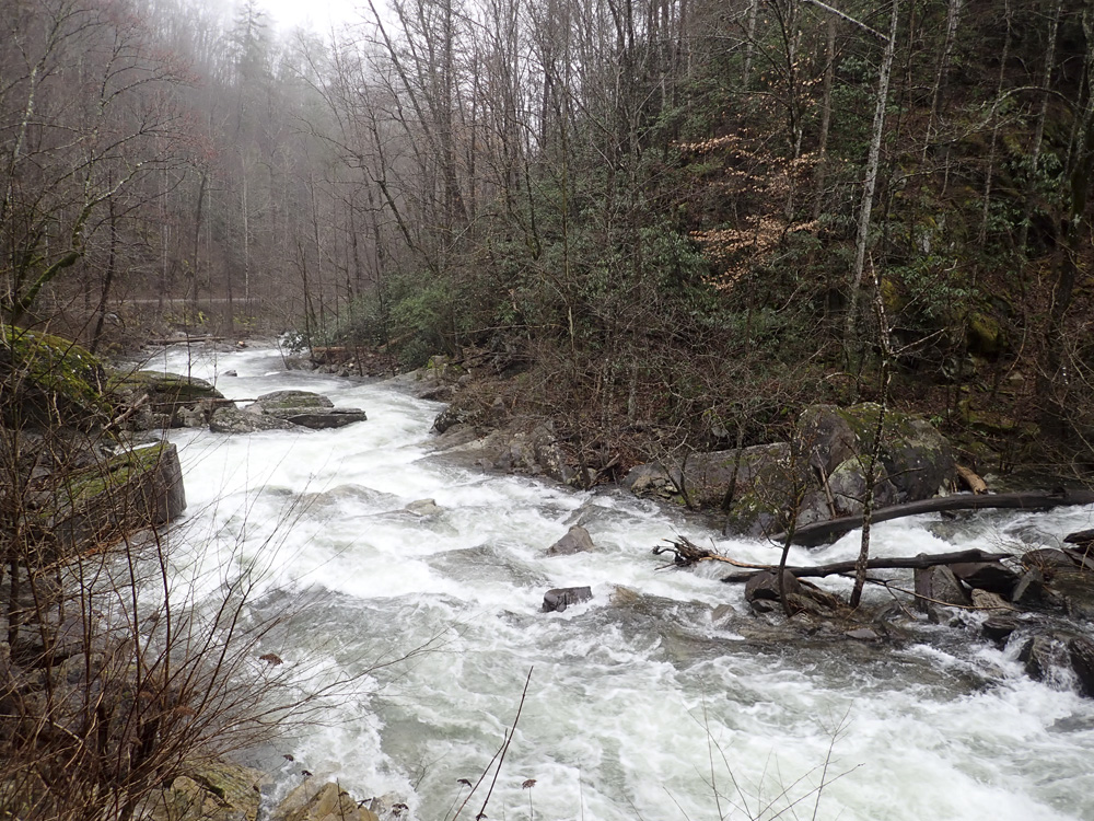
- Doublecamp Creek Confluence on your right.
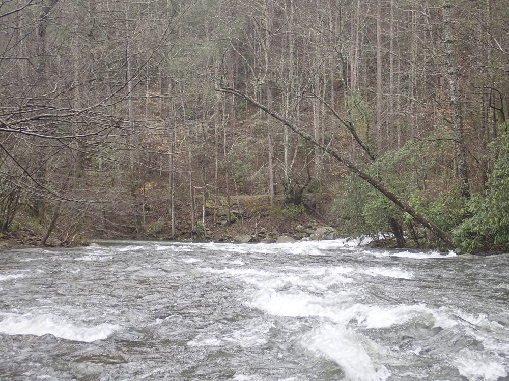
- Optional Take-out at the bridge/campground just downstream of Doublecamp Creek.
- Slide (III+). A nice slide, I ran down the middle to find the deepest water. This involved punching one curler at the top to get on the water.
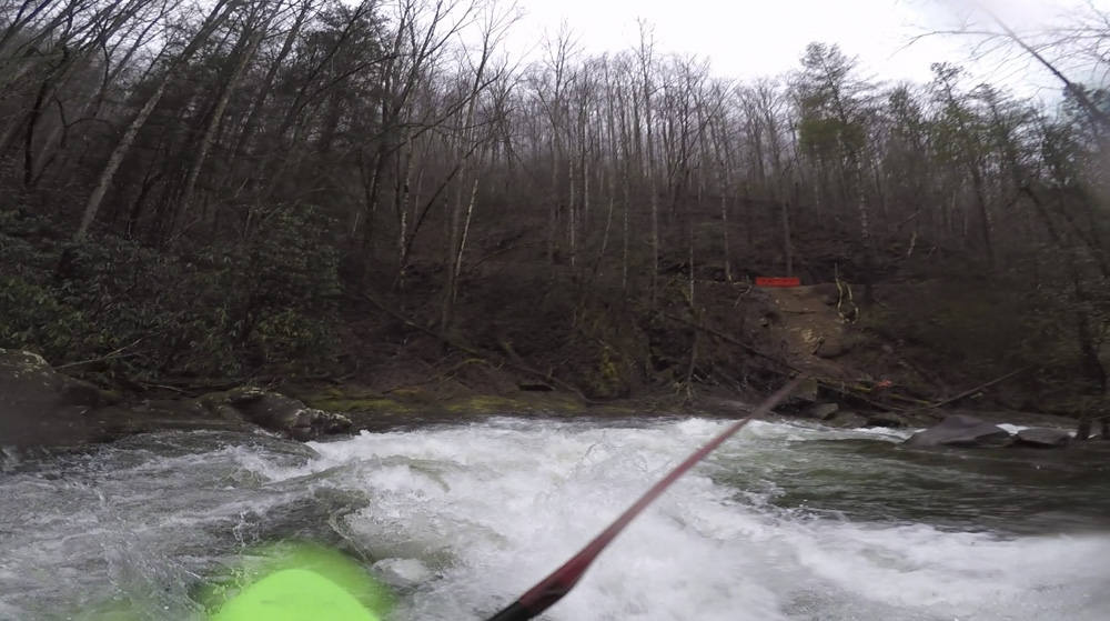
- Dam Lead In (III+ to IV-). This rapid was maybe the next hardest after Pigs in Space. We entered down the right and I cut left in front of a large river dividing rock. Both sides went, but know that the Dam rapid is immediately downstream, and you for sure want to be on the left for that.
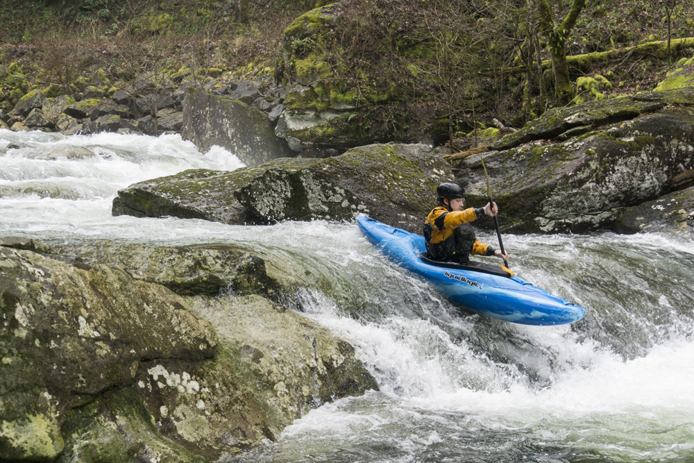
Dam (IV- to IV). The site of an old fish dam, this man made structure was removed in 2015 when they figured out that the invasive lake fish they wanted to prevent from moving upstream didn't move upstream because of the cold water. Now, it is a two tiered ledge. Run far left at the top, down the tongue through the first tier and then boof left for the mellow window of the final hole. If you ended up in the middle, I think a beat down is likely.
Boogie (II-). It is mellow to take out from here.
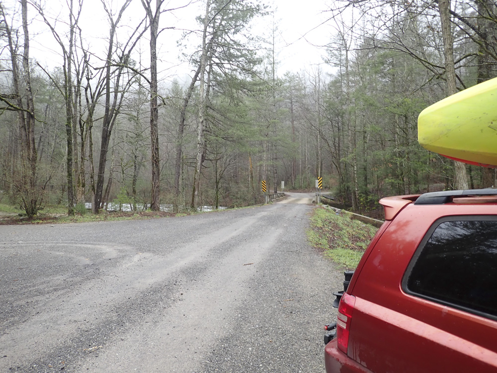
Take-out: Depends on where you are coming from, you can come from the top if you live near Asheville or Tellico Plains, taking Indian Boundary Rd off of the Cherahola Highway. But for us, we took TN-360 out of Venore off of US-411. We took this to the town of Ballplay. From there, we took a left to stay on TN-360 for 1.1 miles before turning left onto Chestnut Valley Rd. Follow this for 1.6 miles before turning left onto Buck Hwy. Buck Hwy climbs up and over the ridge, note that the map has a section of the road being straight, which isn't, so it appears you got off track up there, continue to the river, where you turn right on Citico Rd. Follow the river up for 5.7 miles to the bridge, we parked on the upstream side of the bridge. Or for the standard take-out, you can continue one mile further to the next bridge which is just downstream from where Doublecamp Creek enters.
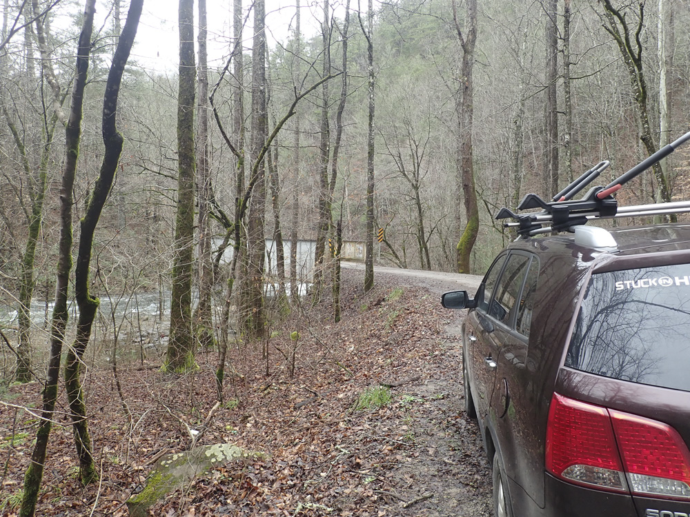
Put-in: Continue up the road for 2.6 miles (from the lower take-out I mentioned above). Just before the road climbs up and away from the river, there is a spur on the left which leads to the low water bridge. We parked just 100 yards downstream of that spur next to the river.
HTML Comment Box is loading comments...