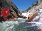
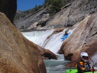
Cherry Creek (Upper)
| Stretch: | Styx Pass to Cherry Lake |
| Difficulty: | Class V to V+ |
| Distance: | 11.1 miles |
| Flows: | 50? to 200? cfs. Or ~500-900 cfs above Hetch Hetchy. Current Dreamflows gauge |
| Gradient: | 162, 163, 150, 207, 291, 310, 492, 163, 15, 185, 224 (From The Island Camp to Dead Bear is 425 fpm for 1.75 miles with two large pools included above and below Cherry Bomb) |
| Put-in: | Kibbie Lake Trailhead - Hike over Styx Pass |
| Take-out: | Cherry Lake |
| Shuttle: | 3 miles of dirt road, 11 miles of hiking. |
| Season: | Early Summer |
| Written: | © 2010 |
| Featured in Video Thirty-One, Roman's Great Video, and the Janney's video of the hard way | |
- Take two water bottles for the hike. The spring is a long way. Also, don't drink from the scummy streams you pass on the hike prior to the stream. You will very likely feel dread when you see the stagnant ponds they all originate from. I am still waiting for whatever illness is coming to me.
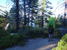
- Try out your pack system before hand, take a walk around you neighborhood. Mine was digging horribly into my arms. Darin ditched his after the first climb and shouldered his the rest of the way. Seth S. has his boat falling off at an angle the whole time creating significantly more work. Hiking 4-7 hours (took us 7 hours with 3 additional of added waiting on people time) in discomfort sucks.
- Bring a mosquito net of some sort, most camps have bad mosquitoes like you wouldn't believe.
- Bring more food than you would think. Several in our group ran out of food by the end. I brought one dehydrated food for breakfast, one for dinner, and two powerbars for lunch and was fine but others needed more as they ate a large amount of their rations on the hike.
- There are camps everywhere, the few listed below are just the ones we used. Literally on every bend there was a perfect camping spot.
- Get a Permit and don't camp at Flinstone... the Forest Service can take this run away from us if we do not follow these rules.
I honestly don't know what I can say about this run that hasn't already been said. This run is arguably (easily) the most famous run in the world. A quick search on google will yield dozen's of blogs with a few pictures of the giant rapids, on youtube you will find videos of people sliding down Cherry Bomb into the grip of the gorge below. Hailed as one of most beautiful places you can see, along with the other High Sierra runs in California, this run should be at the top of ever class V-V+ boaters bucket list.
As a Californian kayaker I sometimes forget how lucky I am. This year (2010) has been a great reminder of just how sought after my backyard runs are. People from all over the country and the world travel to our rivers to experience what so few people who live here ever get to experience. This spring I had kayaker houseguests from Kern County, Trinity County, Humboldt County, Tennessee, Colorado, Missouri, North Carolina, Utah, New Zealand and Germany who came from their homes to visit my local Sierra streams. It certainly puts into perspective just how nice this state is!
This year has been a special one for me. Upper Cherry Creek is something that I never actually thought I would be able to do. As those who know me will attest, I am a cautious boater who rarely takes chances and never likes to get put into a spot where I am in over my head. On top of that, my overall fitness has been in slow and steady decline since High School ended making the idea of an 11 mile hike with a loaded boat seem like as good of an idea has shaking a live bear (don't worry about it if you don't get that reference, it is better for you if you don't).
Two years ago a friend of mine went into the run, although I know that friend has more of a penchant of challenging runs, I knew that if he did it, it wasn't as out of my league as I had previously thought. This was coupled by Darin's endorsement that other than the big ones, I would love the run at a medium-low flow. I really don't know if I can say enough about Darin as a boater and a friend. I can honestly say that there are only one or two other people in the world who I trust so fully. Unlike with many other class V+ boaters, Darin never pressures. If he can tell I am having doubts, he will tell me my options. Sometimes, as on this trip when I was seriously considering portaging Cherry Bomb, he simply says "I honestly know that you can do this." And I believed him.
So anyways, this year Darin invited me on the creek with him and his friends. On Sunday morning we had a group of nine. Then two got reports from someone who had hiked out from put-in and reported flows to be high, they backed out. Others in the group also became MIA as the day progressed (still don't know what happened to them). As the day progressed, our group dwindled down to three. Serious considerations were given to postponing a day or two. However, two things motivated the mission to continue. 1) Jason had already driven from Reno to Groveland and 2) the weather was supposed to cool by 10-15 degrees ensuring lower flows from the "high" that was reported. So with the latter in my hopes and dreams, we left Sacramento Sunday night to camp at take-out that night.
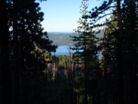
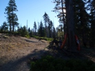
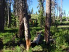
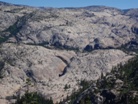
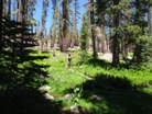
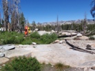
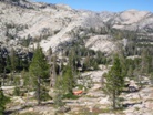
Sunday started early with hopes of starting our hike at 6:00 AM. Realistically, waking up at 5:30 didn't cut it, so by the time we packed our boats, sorted out our backpack systems, and started walking it was nearly 7:00. The reason for the early start is that the hike is long and in many parts with only limited shade. Furthermore, the most difficult climb of the hike begins from parking lot and takes you maybe just less than a mile. From there the climbing continues (albeit at a lesser gradient) for all but the last mile. About 1/3rd of the hike in you get to a beautiful overlook of Cherry Bomb Gorge. About 2/3rds of the way in you get to a saddle which has a short but steep climb just after it. There is also a sign here warning that you are cohabitating with bears. Just after the climb is finished (~200 yards) you will start to see some marshy areas, look for the metal pole near the trail, follow the little stream up 30 feet to find spring water coming out of a pipe. Clear and cold this water rejuvenates the tired mind and body. From here the hike is mostly downhill. As you descend the first open granite slab make sure that you bear hard left at the bottom and follow that trail to the river. Dropping right will only get you lost. If you bear left you will soon find your self standing over the river with less than a mile left of walking. Jumping in a creek has never felt so good as once you have arrived at put-in.
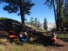
The mosquitoes at put-in are notoriously bad, so we opted to boat about a half mile to camp, although while the sun was up there were no mosquitoes on our granite slab, once the sun went down they were horrendous and we all dove for our mosquito nets. Perhaps going down to the low angle slides would have been better. Of course some folks decide to paddle all the way down to the Island Camp the day they hike in allowing them to complete two day descents. But I figure, I worked my but off to hike in there, why not go slow, take my time, hang out at camp, and enjoy myself. Taking a full 3 days was very enjoyable.
One final thing, I am sure folks will get pissed... but, we went in with the Tuolumne above Hetch Hetchy (just south) was flowing 700 cfs. Day two it was closer to 600, day 3 was closer to 450. I have heard that averaging around 700 cfs correlates to a good medium-low flow. This also illustrates how fast the water dropped out on the creek as 2 days earlier it was averaging 1,000. (Sorry guys, if you didn't want this run to become popular, maybe you shouldn't have put it in every kayaking movie in the late 90s and early 00s... of course folks are going to set their sights on it and dream of one day getting on it!)
Lessons Learned:
A few last thoughts. For the class V+ boater who travels the world or the boater who gets on all the High Sierra runs, this run (at low water) will be a great weekend jaunt. For the class V boater such as myself who never dreamed that they would be capable, this trip will be no less than spiritual. I couldn't help but be in wonder and awe of the beauty of the surroundings, the company of my friends (both new and old), and the whitewater. It is truly one of the great experiences that any person such as myself will ever have in life. I feel that those three days are memories that I will forever cherish and will always, from this time forward, leave an impression on who I am from here on out. It is that good... But be aware, as the flow comes up, the run becomes every bit a class V-V+ run. Update 2016: With all that said, please do also approach this run with caution and respect. In the past 4 years there have been three accidents. My friend Allen died in the bottom drop of Waterfall Alley, another friend got stuck in the weir at Cherry Bomb and had to be revived within the canyon, and just a few days ago a guy from Portland passed away in Cherry Bomb. And of course, there are countless other close calls here. So, although it is an amazing place, please take caution.
As Always, thanks to Darin McQuoid for his contribution of photos. Also check out his write-up for many more great pictures!
Hermann Hesse:
"How he loved this river, how it enchanted him, how grateful he was to it! In his heart he heard the newly awakened voice speak, and it said to him: ‘Love this river, stay by it, learn from it.' Yes, he wanted to learn from it, he wanted to listen to it. It seemed to him that whoever understood this river and its secrets, would understand much more, many secrets, all secrets."
Paulo Coelho:
"If you aren't pushing your limits, you aren't going far enough, and you still don't know who you are."
Mi 0:
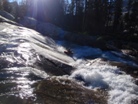
- Put-in Slide (V-). A multi-tiered drop to warm up on just 0.1 miles downstream of put-in. The first tier can be run just about anywhere. The second one you need to be away from the step on the right and the pocket on the left. Just below are some easier slides that lead to a large eddy. Such a good way to start the day.
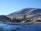
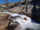
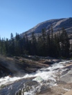
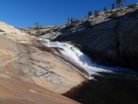

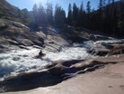
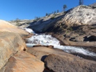
Put-in Slide Exits (IV+ to V). Two stacked drops, the first one is a 10 slide into a rock, some eddy out left and ferry across, others just aim right and try to avoid the rock. Just downstream is an eight foot ledge that can get very sticky as flows increase. Update 2021: A week ago a friend, Joseph Hatcher, passed away in the second ledge at high flow. Please take caution.
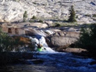
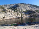
- We camped on the right bank just downstream one more rapid. We first tried immediately below the Slides but found really bad mosquitoes (also apparently the same thing will be experienced at put-in). We found nice granite slabs to sleep on and a plethora of drift wood to burn. There were no mosquitoes until the sun was completely set at which time they came out with a ferocity I have never experienced. We all went to bed early that night thinking that we would sleep soundly after the effort of the hike in. I guess we all had a lot on our minds with Cherry Bomb awaiting us the next day as we all awoke in the morning to reports of laying wide awake for hours prior to falling sleep.
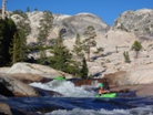
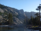

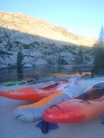
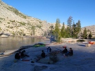
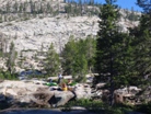
- Low Angle Slides (III to IV+). The next 1.2 miles is spent in a shallow granite bowl. At times you will not see a single tree. All the rapids are straightforward. A few are steeper, you may even hop out a time or two to check landing zones, but all are so much fun. At very low water this section would likely be a chore, at our flow we had just enough to lubricate our boats down the slides.
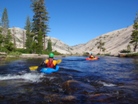
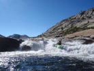
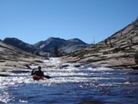
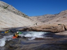
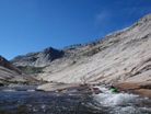
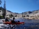
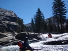
- Easier Stuff (III to IV). Eventually all good things end and you get to some small boulder shoals. There will be a steeper drop or two in here as well.
Portage (U). I do not believe this one is ever run. It ends in sieves, easy portage on the left.
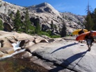
The Slot (IV to V). The next rapid below the portage deserves a look and a rope. A short pinch drop can develop a powerful recirculating hole as flows increase.
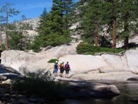
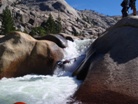
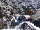
Junk (IV). Just downstream is a junky rapid that can be bashed down or easily walked past the pinch via the midriver island.
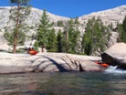
Around the Outside (IV+). After a manky rapid that due to low flow we bashed our way down the right side of, you will find your self in a tight little mini gorge. We went far right and slid our way out. It is a little blind from above.
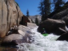
The river then opens up and you enter one of the best parts of the run as the next mile is just full of slides and short falls.
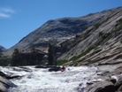
- Steep One (IV+). A steep one run down the left.
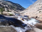
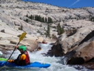
Pinch (IV). A pinch on the far right looked to be the best route. Not wide enough for a boat and water dropping down on the side of you made this drop less trivial than it would appear.
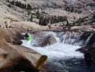
Another Pinch (IV+ to V). At low flows it was easy to ensure that after the long slide you end up on the far right of the river to drop down into the deep water crack in the river.
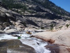
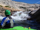
Really Great Read and Run (IV to V). The next bit all blurs together in my mind but I remember it was so much fun!
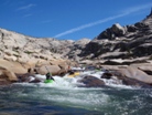
Overhang (V- to V). At low flows the overhang in the top drop was very much in play. Most of us took hits of some degree. You want to drive left in the entry and slide around the overhang. The exit is clean through some holes.
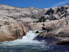
- Class IV Gorge (IV+ to V). The name of the next 0.75 miles of rapids. Even at low flows the gorge contained back to back IV+, at higher flows as the drops link I can imagine it gets pretty intimidating in there. This gorge ends just above the island camp.


Slides (IV+ to V). A few slides and short drops leads you to a nice slide bringing into view a peculiar knob of rock at the base of which is The Monkey.
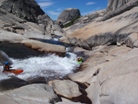
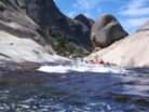
The Monkey (V to V+). A steep drop which looks good enough if you are upright. At low flows it is less often run. Easy enough walk on the left.
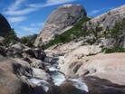
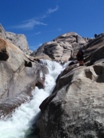
Ledge (III to IV). An easy enough ledge brings you into the heart of the Class IV Gorge.
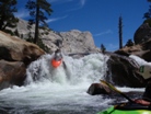
Double Drop (IV+ to V). Two good size holes are made more serious by the presence of the rapid downstream a ledge or two.
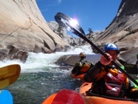
The Cave Drop (V- to V). One of the hardest of the "not big drops," this rapid sports a good hole in the entry, a recirculating eddy on the right side of the hole, and then a second tier whose left half of the river drops into a bad cave. Set safety here for sure. It is walkable on the right as well.
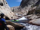
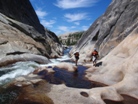
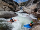
- Slides (IV to IV+). As the canyon opens up you will be treated to a couple of great slides. I remember two having undercuts on the left that were only visible as you rounded a corner or dropped over a ledge. Both are avoidable in time though.
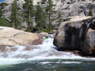
- Island Camp is marked by the splitting of the river around an island. In recent years you also had to portage a tree here. Some folks choose to push here the day they hike in leaving just a few warm up rapids before Cherry Bomb Gorge.
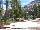
- Pre-Pre-Cherry Bomb Gorge (V- to V). Several long slides and steep falls of 10-15 feet lead to a harder drop with consequence enough that drives many to quickly portage on the right. The pool below this rapid is the last easy egress point prior to dropping into the Pre-Cherry Bomb Gorge.
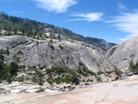
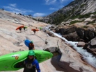
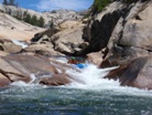
- Pre-Cherry Bomb Gorge (V). A taste of what is awaiting below the falls, you will likely start to notice the nerves in your stomach while running these drops.
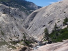
Entrance (IV+). A boof to a sliding drop. Some of us went right with the water and nearly pitoned the wall, there was a trickle going left over a much cleaner line that would handle water better too.
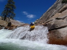
Left to Melt (IV+ to V). This drop sports a good hole after a double pothole sort of thing. It would also be a bad place to partake in some swimming as the next drop is one of the more consequential and there is only a short amount of slack water before it.
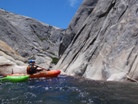
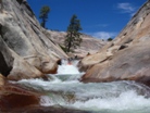
Ugly (V- to V). Darin probed following the water only to pop out and give us the sign to walk. As I look around and see the walking options very thin, I shake him off like a pitcher rejecting the catchers call for a pitch. Upon consideration who instructed us to drive far right. This line worked well, avoiding the rock in the landing and the inevitable beating.
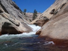
Pool (0). One of the cooler places you will ever be... deep in a gorge, with one of the more committing sections of river that you will likely ever run just below you. It is so peaceful, but so intimidating, just a wonderful place.
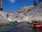
- Cherry Bomb Gorge (V to V+). I don't think this gorge needs an introduction.
Portage (U). The entry is a sieved out mess. Portage down, try to push the roar of the river out of your mind. Get back down to the water, climb the pinnacle rock, and take your first view at the falls. If you really don't like what you see it does look like you could walk up a small shelf crack thing on river left back up to the gorge rim.
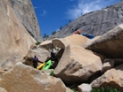
Cherry Bomb Falls (V to V+). Some people enter right and drive left, others swear by entering left and just pointing left. The hazard is to end up on the right or pointing right as there is a bad pothole over there. At low flows it is possible to paddle out (I still wouldn't want to go last). Just below the landing is "The Weir" which sports a good size hole. As flows increase you only get 2 or 3 strokes after landing before the weir. Whatever you do, when you drop over the weir, make your life easier by erroring to left angle. You can surf out on the far left and surfing is easier if you are pointing the right direction (note, there has been a fatality at low flow and several close calls here). Just downstream is a small pocket in the wall that you can set some last minute safety from if needed. Once you leave that eddy, you are going to run the next 6 drops in a row, the holes get bigger as flows increase. Even at low flows, the holes seemed pretty large.
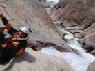

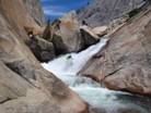
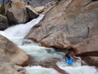
Left. A 6-8 foot ledge which is clean.
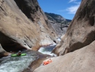
Left. A 6 foot slopping drop into a hole is best run driving on up onto the left wall. Two of us caught our bows on the wall and dropped it backwards, lucky to pogo stick right out, still upright and in control.
Middle. Immediately downstream is short ledge with a good hole at the base. There is then a short recovery section to gather your mind again.
Right. A stepped drop is best run far right away from the powerful hydraulic on the left.
Middle. Immediately downstream is a good size hydraulic that occasionally flips people near the right wall.
Left. By far the most important one to remember, especially if swimming. Drive left to boof around a sieve and then paddle out of the pothole. At higher flows you can go over the sieve. You are now free of the gorge. Hug your friends, smile, laugh, enjoy the moment that you are bringing to a close as you will not have many like them in life.
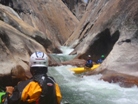
Sieve (IV to U). At low flows we had to hop onto another midstream boulder that didn't have flow going anywhere good. At higher flows you scrape over the right side.
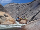
- Slide (III). One short slide and then you get to one of the best sections of water anywhere.
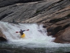
Jedi Slide (V- to V). Think Autobahn on the South Silver. Now triple the length, put some boofs with piton hazards near the end in the steepest section, now also drop it into a good size hole, turn right 90 degrees and drop over another ledge. There you have it. So good.
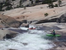

Tea Cups (IV+ to V-). Seven or so of the most perfect tea cups end in a short slide down into the calmest, most open pool. A complete dichotomy from the tight grasps of the gorge above and the relenting action of the river. Complete peace. Feel free to again laugh, hug your friends, cry, run laps, etc etc.


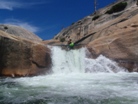
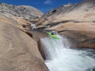
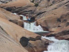
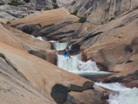
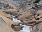

- Flintstone Camp is located on river left of the pool. The Forest Service has requested that kayakers stop using this camp. It is popular with kayakers because you can easily hike back up and run Cherry Bomb, or spend the evening running laps on the slides and tea cups. However, due to the increasing popularity of this run, the camp has gotten overused. Please respect the Forest Service's request and camp elsewhere (either at Island Camp or below Double Pothole are great options). Otherwise, we run the risk of falling out of favor with the USFS and could stand to lose access to the entire river. Thanks.
Junk (IV+ to V). A short slide leads to a right bend in the river. Drive far right, land on some rocks, then boof the ledge and likely land on more rocks. Maybe it is cleaner with more water.
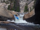
- Grove Tube (IV+ to V). It looks horrible, but trust the folks who have been there and done that. Just slide down the ramp, melt behind the curtain into the unknown. Plug deep and resurface. So good.


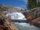
Perfect 20 (V- to V). Not all that hard, but it is still a 30 foot tall waterfall or so (it has to be bigger than 20!). We just ran down the left which moved us back middle allowing for a nice reconnect which boofed several in group out for nearly flat landings. The hazard is the pothole on the left. At low flows Jason paddled behind the falls for 5 minutes while we waited for the others to join us below. Perfectly calm, very surreal.

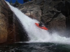
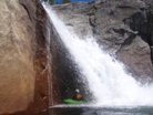
Ledge (IV). Just downstream is a ledge with a sieve, best run on the right. Eddy out on the left to scout Double Pothole.
Double Pothole (V+). The entry is something you never see in video (ok, you occasionally do). Two boofs must be made away from undercuts before slamming into the wall below. At low flows you can put in next to the wall in the eddy. And ferry out in front of it. From there, there is a short slide that then steepens for 5 feet before dropping you 15 feet below. You normally want slight right angle to avoid getting into the left pothole. The second ledge is run anywhere and is good if you are straight. 50 feet below is another 10 foot ledge that is good anywhere.
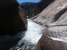
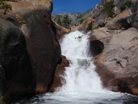

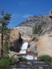
- Double Pothole Camp is at the nice pool at the base of Double Pothole. Just up the granite dome 50 feet are nice soft flat areas. The best part of this camp is that at no point during the night did we get mosquitoes. The bad part, is that the exit of the pool drops you into Waterfall Alley, what a way to wake up! You may also be tempted to scout the Alley, Kiwi, and Dead Bear while cooking dinner which will certainly ensure another night of restless sleep!
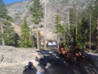
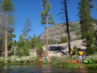
Waterfall Alley (V). A short slide with an undercut on the left is best run on the right at the top. From there, line up a 8-10 foot ledge followed by two quick 3 foot ledges. The final ledge is probably 10-12, this has to be run far left (note, there has been a fatality here due to the pocket on the right). You can now catch your breath. Just downstream is another tall ledge best run far left. This was followed by a shorter fun splat. And then of course the low water sieve portage, from which you can see the lip of Kiwi in a Pocket.
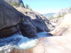
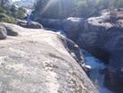
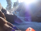
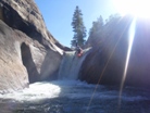
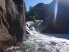
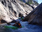
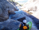
- Kiwi in a Pocket (V+). The most seldom run rapid, Kiwi drops 35 feet or so with a good chunk of the water landing in a pothole that feeds behind the falls 25 feet. The line is committing and involves going far right towards to cave with faith that the flake will boof you back left to the outflow below. The outflow then leads to a 15 footer that boofs you so big. The other option is to hop out on the right, rope boats up to the top of the granite mound (smaller than a dome), and portage Kiwi along with Dead Bear. That seemed like a great option, so I took it.
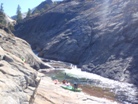
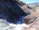
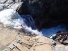
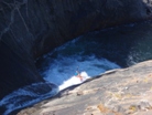
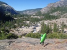
Dead Bear (V to V+). At low flows you have no option but to portage the entry and seal launch into the falls below. At higher flows you can run the sieve pile driving left the whole way before falling the 35-40 feet to the pool below. This drop also has a pothole cave in play, this time on the right. Once you are at the lip, portaging the entire falls is much harder and sketchier than running it. Just downstream are some fun slides that even the portagers get to enjoy.
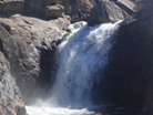
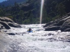
- Headhunter (V). A few easy slides lead you to a steep drop with an overhanging undercut at the bottom that is hungry for heads. It is run, but we walked on the right.
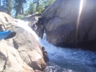
Post Head Hunter Slide (IV+ to V-). Such a great drop. As Darin put it, "on most runs this drop would be the highlight, the fact it isn't is only a reflection of how good the run is!" Slide driving right, boof, keeping sliding, then boof ledge hole at the bottom. Avoid going left as there is a sieve at the bottom against/under the wall.
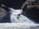
A very pleasant meadow and calm water.
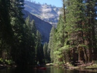
- Portage III-U). Needed more water to make this one possible.
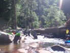
Pin (IV+). In Groveland, on our way to the river, we ran into Ben Stookesberry and Chris Korbulic. They mentioned that they had a pin in this drop that required a vertical extraction of the person, while still in their boat, from complete submersion, after a minute or two of submersion. The line didn't look hard, just boof the left side of the ledge, but we all opted to play it safe and walk.
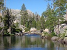
- Nice and easy meadow paddling past the most perfect swimming holes and High Sierra beaches you will ever see.
- Pre-Red Rock Gorge (IV to V). You start to feel like you are again entering granite again you will run a steeper rapid or two. Catch an eddy on the right before a steeper cataract.
Portage (U). At low water at least, there was no line around the rock in the middle of the river kicking up water. Walk on the right.
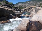
- West Cherry enters on the right. This late in the year it was only a trickle adding in maybe 10 cfs. Just downstream is another big horizon.
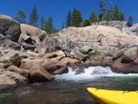
Big F'd Up Drop (V). "Why isn't anyone walking it?" Darin asks me after each failed descent. Darin went first and cleaned it. But after that, pitons, upside down rock time, wall checks, and plugs were the norm. Yet each person walked up and ran it anyways. I guess it shows the mentality you develop after 2 days of solid boating!
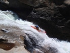
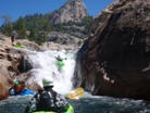
Nearly Red Rock (IV to V). A few nice ledges lead to a pinch and 90 degree right turn. Punch the holes, avoid a piton rock or two lurking the ledges, and round the corner to the distinctly red rocks of Red Rock Gorge.
- Easy then Portage (IV). An easy section of read and run among large boulders will lead you to a dead end. At medium flows you have to portage on the right bank from an eddy that is only 2 or 3 boats big. The portage is also supposedly a pain against the wall. At high flows you can go over one of the lower parts in the sieve. At low flow, you can climb out onto the sieves and drag your boat 5 feet to the other side.
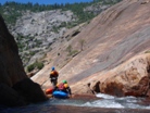
Several fun but rocky drops await until the granite starts to lose its color and the gorge tightens.
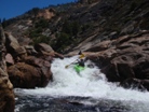
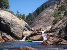
Portage (V+). A steep corkscrew drops lands in a big hydraulic with a sieve immediately downstream blocking the exit to freedom. At low flow we could portage at river level on the left (we scouted from above to make sure we could do this portage). At higher flow you have to go high on the right.
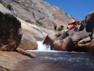
Two Holes (IV+ to V). At our flows the holes were manageable, but I have heard with more water they are macking strong.
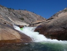
Double Drop with a Sieve (IV+ to V-). A steep and blind double drop is best run left and then left. Just below the second drop the water splits around a rock. 90% of the water goes into a sieve. If you are upright it is easy to avoid.
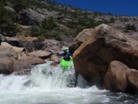
Slides (IV+). Two more sweet slides lead you to a pool and the end of the Ted Rock Gorge.
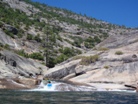
- Mank Portage (V). On the far side of the pool, we portaged on the left. I didn't get a good look at the rapid, apparently it gets run, but it is manky so our fearless leader suggested that we just walk it. We ate lunch at the base of the drop and just above a great section of slides.
After Lunch Slide (V-). So so good. Boof, slide, airplane turn, punch, boof punch. Something like that anyways.
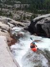
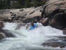
Another Slide (IV+). A great slide with a pocket on the left followed by more sliding down to a fun boof.
I Can See the Lake Slide (IV-). An easy slide that you can see the lake from. However it appears to be at least 225 feet lower than you... but it appears to be less than a mile away.
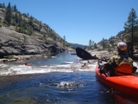
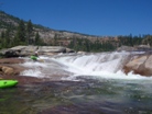
- Final Gorge (V- to V). Some of the hardest rapids are kept for last. If you are too tired, you can walk it all on the right.
Entrance (IV+). A slide into a good sized hole followed by another good size hole.
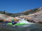
A Fun Fifteen (IV). More of a slide with a reconnect at the bottom than a falls, so good.
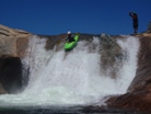
The Cave Drop (V). Drive hard right and point right. Do not look left or you will likely slide down into the cave that is blocked on 3 sides, has a good size hole, and is a foot away from a sizable sieve. We had a scare in here as one in our group had to be extracted with a rope.
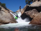

Get Through the First Hole (V-). Not that hard, just make sure you drive hard into the hole at the top. All the outflow ends up in a sieve unless you power through it to the left.
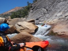
The Nozzle (V). Slide down the left around the corner, then head right. Boof onto the small platform where you will get your glimpse of the pinch drop below. Punch the hole in the middle and the bottom and try not to get surfed.
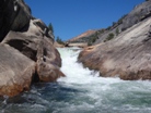
Ledge (III). A small ledge that I am sure gets a good tow back with more water.
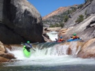
- Depending on the year, you may have to portage the logjam. Once past the jam, paddle across the lake to the point on the left 0.8 miles away. From there it is a short 10-15 minute walk up the trail to the cars.
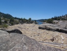
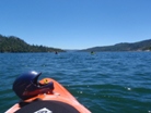
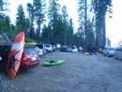
Take-out: From Groveland, head East on Highway 120. Stop at the Ranger Station to get your permit (you can call-it-in in advance and just pick it up, even after hours). Just after you cross the South Fork of the Tuolmne turn left on Cherry Lake Road (like you are going to Cherry Creek on the T). Keep following Cherry Lake Road, cross the Tuolumne. In another half mile, instead of dropping down to the left to the Tuolumne Put-in, stay right at the fork and continue heading up Cherry Lake Road. Cross Cherry Creek. Stay on the main paved road. As you get to the lake, turn right and cross the dam and continue up the lake about 3.7 miles. At a fork in the road, turn left on the smaller and more over grown road Clearance is helpful, a Subaru or CRV type is fine. Continue down about a mile to the end of the road and park.
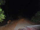 <--(Turn off)
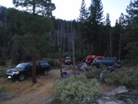
Put-in: Get back on the main dirt road and continue another 2 or 3 miles to the Kibbie Ridge Trailhead. On the hike, a few things to note. There is a fork after about 1.5 miles. Stay left towards Styx Pass. Also, near the end, about a mile after the Spring, at the bottom of the granite slope. Take a hard left and follow the trail to Styx Pass (no sign, trail is poorly marked). The hike takes people 4-10 hours. Most people get it done in 6 or 7 unless they take naps and extra long breaks. It has been done in as few as 3.5 hours so I have heard. Though that seems crazy fast.


HTML Comment Box is loading comments...

