Chattooga River (Section 0)
| Stretch: | Bull Pen Rd. bridge to Burrell's Ford bridge |
| Difficulty: | Class III to IV (V) |
| Distance: | 5.4 miles |
| Flows: | 350 cfs to 1,500 cfs (illegal if the flow hasn't hit 350 cfs that day... some say lower is ok. Personally, we had 400 and 100 cfs more would have been welcome. Check out American Whitewater's current flow gauge |
| Gradient: | 128 fpm average for 1.7 miles and then 40 fpm for the remainder |
| Put-in: | Bridge on Bull Pen Rd. |
| Take-out: | Bridge on Burrell's Ford Rd. |
| Shuttle: | 14.2 miles. 30 minutes one way. Mostly on good dirt. |
| Season: | Only legal from December 1st to April 30th. After rain... runs a lot thought |
| Written: | © 2018 |
| Featured in Video A Wet State #135 | |
I have been avoiding these runs for a while... really hoping to get an overnighter on section 00, 0, 1, 2, 3, and 4 all in one go. I have done 4 a few times. But never any of the others. But, after 4 years I haven't managed so I decided to go ahead and bite the bullet on a day that it had water, with room to grow, and there was concern about other things popping. So I made a few calls and organized a group for 00 and 0.
The morning of however, flows had continued to drop and I found out that 390 cfs would be really low for the 00 section. Apparently 700 is a more ideal flow. So with that in mind, we decided to just to 0. Long drive 3 hours from Knoxville for just 1 mile of whitewater and 4 miles of flat water. But with as much as I have been working lately, I really can't pass up any days on the river which can bring new runs to be honest.
The run starts off with a bang with one of the two biggest rapids. Plenty of people walk it, but it is also a great rapid and that good to go at all sorts of flows. Below, you are greeted with some bed rock that then turns to boulder gardens as you approach the main event for the day, Super Corkscrew. This rapid is a steep, congested, ricocheting whitewater thrill ride... that hopefully I will get to partake in next time.
Last week, we had our epic on Santeetlah. Somewhere in that day I apparently pulled a muscle in my left triceps. I honestly didn't notice until mid-week when putting on my socks hurt a lot. By the weekend though it was feeling better so we went to boat. At the put-in though, as I took my first strokes into Bull Pen, I feel my arm pop with each stroke. The pulled muscle went to a torn muscle and my left strokes were done for the day... so, no Super Corkscrew for me today!
Below the biggest rapid, many more fun boulder garden rapids await. There are a few hazard spots and wood is always a concern. But with a cautious approach and strategic eddy hoping you can sort it all out.
In hindsight, due to my arm I am glad we didn't decide to do 00 or 1 with 0. But, as a stand alone, this run felt too brief for me to be worth the long drive. I would wait for better flow and add either the upstream 00 or the downstream 1 to it if you are driving from such distances. But, it is worth doing for sure. Especially when you are seeing friends from down south that you don't always get to boat with.
A few other things to note. This section along with the one above it was illegal until December of 2012. Thanks to the hard work of AW, it is now legal. However, there are rules that should be followed. Please do.
The new rules include:
- 1. Allow paddling to occur between Green Creek (top of section 00) and Lick Log Creek (bottom of section 1)
2. Allow paddling to occur between December 1 and April 30, on days when flows have hit 350 cfs or higher.
3. Permit must be obtained. Bull Pen Bridge or Burrell's Ford (GA side) are easiest for this reach.
4. Paddling banned on the uppermost two miles of the Chattooga, the lower four miles, and all tributaries all year.
5. Ban paddling from May 1 through November 30 on the entire Upper Chattooga, and on all days when flows have not hit 350 cfs or above.
6. Impose no direct limits on other similar visitors.
Mi 0.0:
- Bull Pen (IV+ to V-). A ledge drop leads to a corkscrewing s-turn. Normally you enter middle to exit left of center. At our low flow, we entered far right to avoid a log that was in the middle.
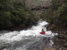
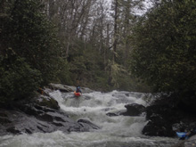
- Entrance Ledges (IV). The first ledge is maybe 6 feet tall. We ran down the center. I bet as flows come up this develops a meaty hole. Below is another small slide that we ran down the middle.
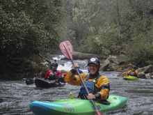
Boogie (III-). A few small ledges fill the next straight away.
- Rock Garden #1 (III to IV-). We entered far left. Some then banged their way down the left avoiding the sieves at the bottom left. Others ran down the right which then move you more towards the sieves.
- Super Corkscrew (V- to V). Scout on the right as this rapid is large, has some hazards in play, and often collects wood. Enter the first drop wherever has flow. Then go down the main entrance far right and line up the hole. This then moves you right... let it take you right, though mind the undercut right wall. This then drops you onto a slide to exit. Portage is on the right as well and pretty easy though muddy if it rained recently.
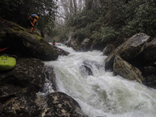
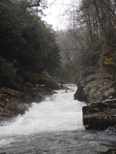
Boogie (III-). Some fun little rapids start immediately below.
- Split and Boof (III+ to IV-). After a straight away, there is a large rock splitting the river. The left is the normal line, though it also collects a lot of wood. Below there is a nice boof on the left to exit the narrow gorge.
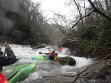
- Last Hurrah (III+ to IV). The bulk of the water goes left. However, this ends in a pothole and pinch that collects wood often. We stayed in a micro channel on the far right. More water would be great for this area as the exit was junky. Below, the river moves through some fun waves into an undercut at the bottom that is easy to avoid to the right.
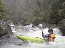
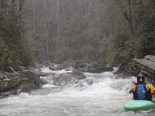
Last Rapid (III-). One more rapid takes you to the end of the run. You can go left or right.
- Fowler Creek: Then a few hundred yards later there is r creek that enters on the left, that marks the start of the mellow paddle out.
Take-out: From Sylva NC , take NC-107 south for 39.2 miles. Look for the small paved right turn onto Burrells Ford Rd (FS646). Follow this for 2.7 miles which is mostly on dirt. There is a campground before the bridge with a toilet. Just after the bridge there is a parking area on the left.
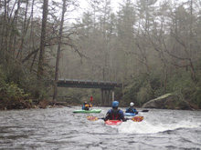
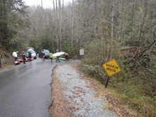
Put-in: Go back out the 2.7 miles to NC-107. Turn left. Continue for 6.2 miles before turning left onto Bull Pen Rd. Turn and follow the road for 3.6 miles to a triangle intersection, stay left and continue for 1.7 more miles as you drop into the river canyon. This too is mostly on dirt. But the first is in good shape.
HTML Comment Box is loading comments...
