Carrabassett River (North Anson Gorge Falls)
| Stretch: | North Anson Gorge Falls |
| Difficulty: | Class III to IV |
| Distance: | 0.35 miles |
| Flows: | ~600 cfs to 3,000+ cfs. USGS Carrabassett in North Anson gauge |
| Gradient: | 114 fpm average |
| Put-in: | Railroad Bridge near Hall St and ME-16 |
| Take-out: | ME-201A Bridge in North Anson |
| Shuttle: | 0.3 miles, (2 minutes one-way) |
| Season: | Spring from snowmelt, summer and fall from rain |
| Written: | © 2021 |
-
North East Road Trip 2021: Day 6
Finally, the day we had been waiting for... the day 1" of rain was to fall had arrived. And... nothing. Nada. So, we went for a hike near the Kennebec, up Pleasant Pond Mtn via the Appalachian Trail.
The prior day, just near where we were staying we had driven over the river in North Anson and I looked down and saw rapids. So, after our hike was finished, with nothing better to do in the afternoon as there were very very limited options, I thought "lets drive the 20 minutes to that rapid and run that!" I knew from google maps that the rapid was actually longer than what you could see from the road, and it looked like there would be 4 or 5 fun moves in the section, so it seemed like a worthwhile use of our time. I sent a note to a few of our new and old Maine friends and none of them had done it before... but I didn't let that deter us! Desperate times call for desperate measures! AW has this as the take out of a long 20 mile class II to IV section, but we had no time for a 20 mile day. So this fit the bill nicely to run a fun short section after the hike.
Arriving at put-in we geared up and I found I had forgotten my skirt. Dang it. I guess we would be taking solo laps and I would be stretching Diane's skirt out! Its too bad though because the section was fun enough we would have done a few laps. But by the time we both got one lap in, Aster was getting tired and we headed back to our digs.
The river indeed has a few rapids to it. It builds into the section you can see from the 101a bridge in town. A stacked section of class III gives the run an overall feeling of class IV- to IV. We had ~900 cfs which is the lower end, but totally worthwhile. I would imagine if the flow is 2,000 it would feel class IV for sure. Note, there is one last rapid directly under the highway bridge. It comes as a surprise as you run the rapids as there is no indication it is there from the road! It is straight forward though, just run far right around the large hole.

Mi 0.1:
- First & Second Drop (III). The first drop was best down the far left channel. It was a ramp that was straight forward and led directly into the next drop. The second drop was a small hole that we punched our way through on the left.
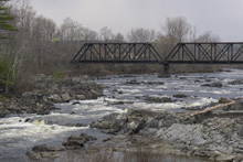
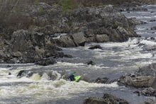
- Third Drop (III+). The next series down to take out all happen back to back with eddies between them It starts with a ramp down the main flow into a bit of a hole. As I recall I went down the center driving back to the right.
Forth Drop (III). A ramp again in the main flow that was rockier that we also ran center and then dropped into the eddy on the right to scout the ledge below.
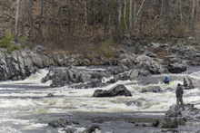
Fifth A Drop (IV-). The river splits and both sides are runnable. I am calling the right side the A side as it is what we ran first. It is a broken ledge that we ran right of center. There are pin rocks if you choose the wrong spot. As it was there was also rocks in the landing of the right spot so make sure you get a good boof here. Below is a channel wide hole that can pack a punch. I ran it center driving left to then eddied out behind the island. I then got out and carried back up to run the left channel which I call B.
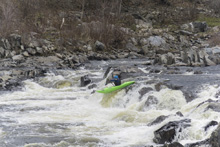
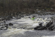
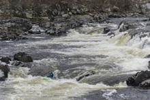
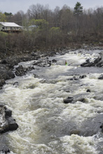
Fifth B Drop (IV). The B channel is a small creekier line. Consisting of an s-turn that you want to hug right as it bends right to avoid piling up on the rocks on the left. This is the hardest individual drop in the section.


Sixth Drop (IV-). Three offset holes, right, left and right again one after the other. Diane ran right through the two larger ones, hitting the edges of both. I threaded the needed between them down the middle. You could also probably sneak them to the left.
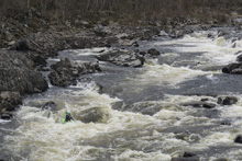
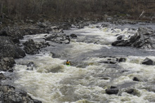
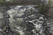
- Seventh Drop (III+ to IV-). This one will be a surprise as you cant see it from the bridge at take-out. But you can see it from the Fifth Drop so at least it isn't a surprise. It was straight forward to run down the far right and just avoid the rather large hole. This is a good call as the hole has a messed-up rock in it, so as if the hole wasn't bad enough on its own (it is) it also has some ugly piton potential.
Take-out: In the town of North Anson on Highway 201A, at the bridge on ME-201A. We parked along the back side of a government building. It said employees only but it was a weekend and no one was there. There was also parking 100 feet further up the corner of the L shaped "Water Street."
Put-in: On the North side of the river, turn left onto ME-16 and go 0.3 miles. We had a shuttle driver so we quickly access the river from a auto shop directly across from the railroad bridge. Worst case you could just walk the 0.3 miles from takeout and not worry about driving to the top.
HTML Comment Box is loading comments...
