Big Creek (Lower)
| Stretch: | Big Creek Trailhead to the Pigeon River |
| Difficulty: | Class III to IV |
| Distance: | 1.95 miles |
| Flows: | 2.5' to 4.5' per the bridge gauge. Holds well (a day) after decent rain of 1+". |
| Gradient: | 149 fpm average |
| Put-in: | Big Creek Trailhead |
| Take-out: | Before the Waterville Rd Bridge |
| Shuttle: | 1.7 miles, less than 5 minutes one way, some good dirt. |
| Season: | Fall, Winter, Spring and early Summer from rain |
| Written: | © 2018 |
Lots of rain fell the prior day, but surprisingly, only a handful of options had come in. With hopes of getting a new run, we agreed to a day with Jim, Caleb, and Emily. Their plan was to hike up Big Creek. With Diane 4.5 months pregnant, however, neither the hike with the kayak nor the steep rocky nature of that section seemed like a good decision. So, while they did that, Diane and I did the Lower section of Big Creek which is a couple steps easier and safer for the baby. I was happy too, as I had done Upper but had not done the Lower, so a new run was achieved. We did two laps on the run, I thought that the river was going to be really low, at 2.8-2.9 or so, but this actually ended up being good fun still, with an exception of the very last rapid. That one is a piece of you know what. The rest of the run however was a continuous smoky mountain typical affair, but limited to class III rapids that I am sure at higher flow, due to the continuous nature, earn a class IV rating. To our surprised, we enjoyed it enough that we did a second lap on the run.
This run is a great intro to typical smokies whitewater. I thought it was similar in difficulty to the rapids on the Little, below the sinks and above the elbow. But, perhaps not quite as big of climaxes but also more continuous. I think it is very complimentary for anyone capable of the Little, also be capable here. Swims here though could result in some bruises, so get a solid roll before venturing out here.
For those stronger boaters, it is easy to add this to the Upper, and I would recommend doing that at least once. This run only takes 15-20 minutes to figure your way down if you are strong.
As for the rest of the day, when the rest of our group finished their Upper lap we headed down to the confluence with the Pigeon for an afternoon Dries lap. We found the flow was ~3,000 cfs however and Diane and I bailed. I think we made the right call for us, as that is really high! But, I had gotten it twice already this month, and ended up getting it again a few days later, all at more reasonable flows, so really it was no sweat off my back to skip this day.
Mi 0.0:
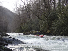
- Boogie (III to IV-). From the get go, this run is defined by continuous boogie rapids. I will just call out a few of the climax moves that I took note of during our run.
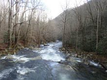

- Ledge (III). A section of easier boogie leads to a ledge, on the first lap we eddied out in some slack water on the left to boat scout it. The ledge was in the center of the left channel and was a few feet tall.
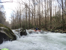
- Boof (III+ to IV-). A busy section of boogie ends in a river wide rock fence. There was an obvious boof left of center off of a shoulder of a rock. Below, is the first real pool of any sort since put-in.
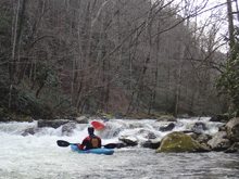
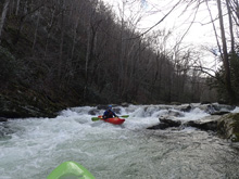
Hole (III). Not far downstream, there was one noticeably stickier feature in a rapid where a hole was formed by a small poorover through the main channel. It was totally find if you were straight and taking a good stroke. Just putting it here as it stood out as a place that could mess with first timers.
- S-Turn (III+ to IV). The biggest individual rapid on the run comes within site of the bridge where the gauge is. The river s-turns to the right, left and back right with some off angle holes to line up and punch. We went down the center of all of them which went well, but I can see the off angle holes and cross currents immediately behind them could give people issues. The bottom is a small ledge, I boofed a shoulder right of center, though really any number of places was ok to exit.
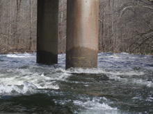
- Mt Sterling Rd Bridge (III). The gauge is located on the upstream side of this bridge. Downstream, some nice boogie keeps you busy, though it is less channelized and less difficult than the stuff you have run upstream.
- Island (IV). The river splits around an island, it is good to look at this from the road on the drive up. We took the left channel. The first 0.1 miles of this island are mellow class III-, but the cascade as the river drops back together is a place where pin spots are plentiful. We ran generally right. Keep it straight and hairy side up!
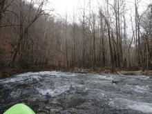
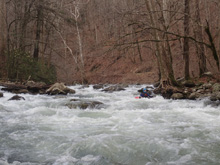
- Take-out before the Waterville Rd Bridge. Note, if you continue there is a weir downstream that may not be runnable depending on your flow.
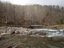
- Weir (?). A low head dam, at high flows, avoid this. Take-out above. If you want to take out at the Pigeon Gorge put-in or continue through, scout this on the drive up. There isn't a good place to stop right above it at river level.
Take-out: Take-out: From Knoxville take Highway 40 towards Asheville. Take the last exit before crossing into North Carolina, exit 451 toward Waterville Rd. Turn right onto Waterville and stay left to follow it up the Pigeon River. At the confluence with Big Creek there is a large rafting access. Most people will continue up Waterville Rd though, crossing the creek twice in 0.2 miles and parking just on the far side of the second bridge.
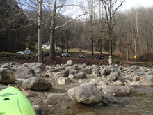
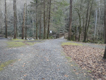
Put-in: Continue up Waterville Rd. In 0.8 miles you will cross Mt Sterling Rd, this is where the gauge is, on the bridge on that road. Continue straight across Mt Sterling Rd onto Big Creek Campground Loop Rd which quickly enters the National Park. Follow it for 0.9 miles. Don't be fooled into dropping down into the horse camp, stay on the main road until you get to the parking at the trailhead.
HTML Comment Box is loading comments...
