Bee Creek
| Stretch: | Private Property to Caney Fork |
| Difficulty: | Class IV to V- |
| Distance: | 2.45 miles |
| Flows: | 450 to 900? on the Caney Fork gauge (I have been told from those who have run it high that it was burley). Check out American Whitewater's current flow gauge. |
| Gradient: | 153 fpm in the gorge, 118 fpm overall |
| Put-in: | Above Squeeze Play |
| Take-out: | Caney Fork at Scott Gulf Rd |
| Shuttle: | Either long 1.5 hour drive and a paddle in, or a 2.2 mile hike w ~500 ft elevation gain). Take-out needs 4 wheel drive and some clearance. |
| Season: | Winter and Spring, rain |
| Featured in Video A Wet State #97 | |
| Written: | © 2014 |
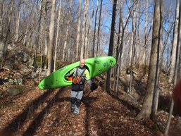
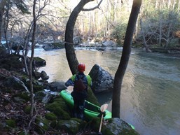
Man, this run is a bit of a mixed bag... more so even because of the added adventure that our day detoured on. First off... for comparison to back in Cali, the run is a lot like Bear River in Colfax. Really fun class IV to IV+ rapids, a short length of rapids, and more sieves that you ever want to acknowledge. Like, a lot of sieves. A lot, a lot. But also really fun moves. But the other downside comes in the form of the shuttle. Either 1.5 hours or so one way, or a 2 mile hike up the mountain. We opted for the hike as we didn't want to drive two cars out from Knoxville. The hike wasn't horrible, but it did climb a fair bit and was on a cobbly old decommissioned road. But big kudos to Kirk Edelman for sorting out the logistics of the hike, and rumor has it that he is currently also flagging a hike on the other side of the river that will be easier.
The adventure I mentioned came in the last big rapid, two class IVs from the paddle out. One member of our group got knocked off line by a hidden rock and took a swim down the rather sievy rapid. Luckily both he and his boat got themselves to shore before going any farther downstream. The catch was they were on opposite sides of the river. As we portage his boat down and prepare to ferry it over to him, he opted instead to swim across the narrow creek. And luck was not on his side. As he jumped in, a rock he was not expecting hit his leg and he quickly knew he badly broke it. As we take stock of the situation, we begin to splint his leg and discuss options. Hiking him out would be tough, the canyon is rugged and we have over a mile left. We thought we still had at least one big rapid left, so the idea of heading downriver was also not appealing. But with only an hour of sunlight left we decide to quickly head downriver and portage he and his boat around any rapid he can't run in his state. To our surprise though, despite constant draining of the canoe, he toughed it out, running all of the remaining rapids and getting us to take-out in now time at all. 2 hours later as we arrived at the Emergency Room at UT Medical Center, he was quickly declared a trauma case and moved through triage into the back rooms.
For Jon and I the night was not yet done with curve balls. After dropping off the truck at our injured friend's house we had Diane pick us up (at 9 pm) and head back to my house where Jon's truck was. As we try and fail to get his truck to start... I realize I left all my layers at our friends house, in front of his truck. As I make the drive back over to collect my layers so that I can boat the following day with dry layers, Jon calls his wife to come and pick him up due to his truck not starting. In the end... all three of us needed our partners to come and pick us up and take us home. At least Jon and I got to go home that night. Our friend spent the night in the hospital, had surgery early the next morning, and spent the following night in the hospital recovering... over New Year's.
The rapids are all in quick secession in the crux section. They are spread out evenly so I won't bother estimating mileage for each.
Mi 0.0:
- First Rapid (IV to IV+). The first rapid we ran down the middle and then exited left. The left although good to go also had a bad undercut and wood in it. A warning of the hazards to come downriver.
Squeeze Play (IV to V). Probably the toughest rapid on the run, this rapid comes directly below the put-in rapid. Scout it on the left and make sure to scout through to the bottom. Boof the right side of the left channel. Then drive down the middle making sure to keep away from the huge deep undercut on the right in the narrow pinch. The exit was clear far left moving back hard right.
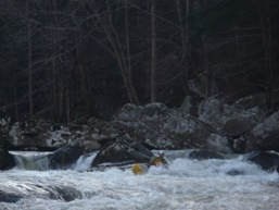
Boogie (IV). Two boogie rapids, the first being a wall of rocks with a few clean lines, probably the easiest on the far left. The second rapid was a lot of fun and had several steps and holes to navigate. We went down the middle. As flows come up the bottom hole in that rapid may get grumpier.
Charades (IV). We scouted from the right and then gave beta to Clay to get a river level visual of the left. The line was to drop a cool little boof moving left to right to stay away from the recirculating eddy on the left.
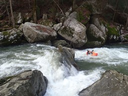
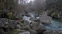
Stinger (IV+). A straight forward but big rapid. Run down the middle and boof the right of the horn at the bottom. One of the better moves on the run. Note however, you have to work away from the sieves that the pool quickly flushes into. The exit move is a bit ugly. You want to go down left of center between the two goal posts, with left angle (which points you towards an undercut sieve). Land and paddle away.
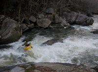
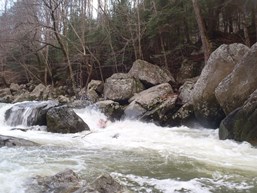
S-Turn (IV+). The next rapid was tricky... but perhaps we would view it less tricky if we could tell you that the right channel went or not. We boat scouted and couldn't get a look so we wanted to avoid that channel. The move we chose was a right channel hard to the left move into an eddy on the left. The exit was a simple boof. The right channel may go... we had to fight through a curler to avoid finding out though.
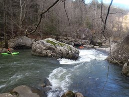
Matt's Demise (IV+). The rapid is a rock pile, and at the bottom on the left is a big undercut with significant water coming out the back end of the house size rock. You can enter on the far left, but be aware the current moves you fast away from the boof towards a boulder fence. The exit is the tricky part, a ramp leads down to a gauge rock that pushes you into a house size rock with lots of water going under it. Jon hit it straight and back ferried after pitoning the hazard. I ferried directly in front of it after banging down the left. There apparently is a manky line down the far right that is doable (though not fun) but we couldn't see from our scout on the left.
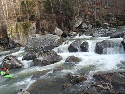
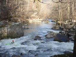
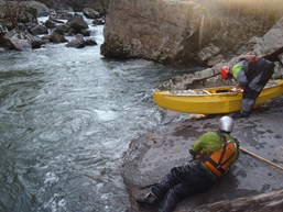
Right Channel (IV-). A nice slot down the far right shore boasts a nice little hole.
Slide (IV-). One last good rapid, we ran down the right of center off of a boof rock of a few foot drop.
- Below, the river turned into class II to III all the way to take-out.
For more details on the run, see the AW write-up...
Take-out: Get to Crossville, approximately 1:15 hours west of Knoxville on Highway 40. Take US-70 west out of town and follow it for 16.5 miles. Turn left on Eastland Rd and follow it for 5.8 miles until you turn right on Scott Gulf Rd. (not you can also come in from the other way on Eastland which saves 2 miles but according to google takes 5 minutes longer). Scott Gulf is pretty messed up right now and you need clearance. I think my Highlander may have problems with it in its current state. Follow it for 6.4 miles down to the river.
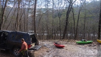
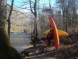
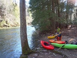
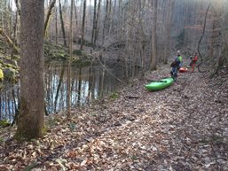
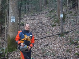
Put-in: We did the hike method... if you want to drive to the top, consult a map. Kirk Edelman has done a great job figuring out the hike logistics and is currently flagging a river right option that is apparently a little easier. We hiked river left. The idea is, walk up to the pool above where you parked and ferry across the river. Just up the Bee Creek 100 feet get out on creek left (downstream side of Caney Fork). High along the creek cutting the corner off a turn and up a small climb in order to drop down into a pool. Paddle up the pool and get out at the top of it again on river left. Walk up river for 100 yards on the faint trail which then bends right and you will see a sign for Rose Cave. Follow this uphill and onto an old decommissioned rd. You will follow this for 2 miles, you end up approximately 500 ft above the river and a fair distance away from it. Eventually it flattens out, you will then start to get close to the river but continue on past a couple dry culverts as well as two small creeks that have water. Cross them. When you get to a small pond, you are really close. Stay right and continue until you see two very obvious Private Property signs on the trail. Go left into the woods following flagging and walk down the hill 100 yards to the river. This drops you at the top of the first rapid.
HTML Comment Box is loading comments...
