Kern River (Miracle to Democrat)
| Stretch: | Miracle Hot Springs to Democrat Rd. |
| Difficulty: | IV- to IV+ |
| Distance: | 11.2 miles |
| Flows: | 600 to 5,000+ cfs. Current Dreamflows gauge |
| Gradient: | 30.6 fpm average |
| Put-in: | Miracle Hot Springs |
| Take-out: | Democrat Rd |
| Shuttle: | 13.5 miles (20 minutes one-way) |
| Season: | Spring and Summer from dam release |
This run has been in the back of my mind since I first went to the Kern 5 years ago. However, due to low water every time that I was in town, the opportunity never presented itself to me. This year however, due to unprecedented high snow pack across California, Lake Isabella was full come April and the Lower Kern was flowing a healthy 2,300 cfs during the Kern River Festival weekend. So, as it was my birthday, I got to make the call and we were off to the Lower Kern.
I had been warned that there was substantial flat water, but what I didn't expect was the infrequency of rapids. In the 11 some odd miles, there are literally like 7 rapids that are class III-IV and only a handful of in between stuff. With that said, we should have taken our playboats because there was also some amazing play at these flows. Nice fluffy holes, large green waves, and row after row of standing waves. I thought the river was certainly fun, and I can see why it is a commercial rafting classic… it has all the makings for a fun trip while not requiring a prior experience with whitewater. Likewise, it would also make for a great class IV step up run as you will only be stressed a handful of times during the run and if at any time you feel over your head you can escape to the road above. However, for someone comfortable on class IV and looking for a class IV day, you may be a little disappointed when you can go upriver to Ant Canyon or Chamise and get the same amount of rapids in a fraction of the miles.
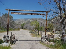
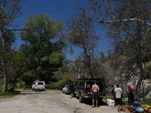
Thanks to Brett Duxbury for the images of the run. His pictures were taken at 1,000-1,500 cfs. I forgot my point and shoot so I only got pictures at Royal Flush, put-in and take-out... the one time we got out of our boats.
Mi 0:
- Put in at Miracle Springs, though the hot springs have been demolished thanks to some rugged hippies who took over the area (so I have heard), the put-in in still nice and developed. Class II-III rapids keep up at a good pace between the major rapids until after Royal Flush where the river is much more flat between the rapids.
- White Maiden (III+ to IV). We ran down the center. There was a hole on the right and left at the bottom, down the middle was fine.
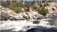
- Sundown Falls (IV-). Fresh off of a beating a week prior when I went on faith that the beta I was given was correct, this time although the horizon looked bad, the beta ended up fine. Center left then back right through the two step drop.
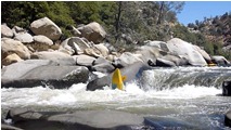
- Dead Man's Curve (AKA, something involving a Possum, I wish I remembered what it was…) (III+ to IV). We entered down the center and then worked left away from the wall.
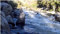
- False Flush (III). You know you are getting close when you start seeing 15-20 foot tall granite walls to the river. The rapid was straight forward with some swirly eddies below the wave trains. Look for the portage sign on the right and 100 yards downstream portage Royal Flush on the right.
Royal Flush (V). It has a line, even two lines, but sieves and the bad undercut on the left wall talked all of us into walking it. It is much uglier than any of the pictures of it let on.
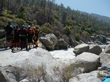
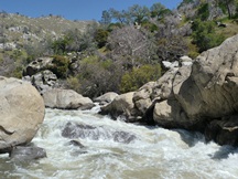
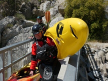
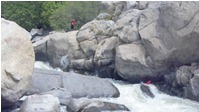
- Hot Springs on the right, due to a loop hole that to maintain a mining claim you only need to mine 40 some odd hours a year, a family has set up a shanty camp at the hot springs as they secured rights to the claim. I am sure the water is much dirtier downstream of here. Though, I also think after the inevitable high water coming later this year (2011) their camp may be gone. Half a mile downstream, highway 178 passes overhead. Some folks take-out here and others put-in here making for shorter days. The lower few miles packs a more dense punch of rapids, though no more difficult than those upstream.
- Hari Kari (IV-). On a slight left bend the river drops over some rocks and then makes a 90 degree turn right. We wanted to stay off the left wall due to a hole on the wall. All went fine.
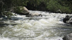
- Horseshoe Falls (III+). We entered center and then headed left to avoid the rather large hole making the falls itself. Nice clean green water ramp as long as you make it around the falls.
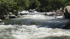
- Pin Ball (IV). I thought this rapid was the hardest, at least at our 2,300 cfs flow. But that may also be because we boat scouted through it and went for harder lines. There were plenty of holes to avoid and holes to punch if you wanted to… or if you get off line in a sneak line. Fun rapid though, in a raft I can imagine it would be hard to avoid all the features. Luckily, my rafting days are behind me!
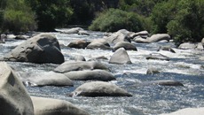
Take-out: 14 miles south of Lake Isabella on Highway 178, turn left on what I believe is an unnamed road, just downstream and across from Democrat Rd. Follow this quickly down to the river access. The take out is on river left… If you prefer the Republican way… figure it out for yourself on the right. (lame political joke, but I couldn't resist).
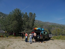
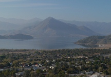
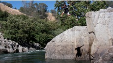
Put-in: Head back to Highway 178 and head North for 10 miles. Turn right on Borel Road, climb steeply but briefly and turn right on Kern Canyon Road and follow for 2 miles down to Miracle Hot Springs.
