Tennessee River Gorge Segment
| Section | Sub-section | Miles | Elevation Gain East to West (ft) |
Elevation Gain West to East (ft) |
GPX File (Right click, save as) | AllTrails Link |
| Signal and Edward Point | Full Segment - Signal Point to Highway 27 | 8.8 | 1,660 | 2,120 | Link | Page |
| Signal Point to Edward's Points | 2.9 | 450 | 550 | Link | Page | |
| Edward's Point to Highway 27 | 5.8 | 1,210 | 1,600 | Link | Page | |
| Tennessee River Spur Trails | - | - | - | - | - | - |
| Poplar Springs (Spur) | 5.2 | 630 | 1,030 | Link | Page | |
| Mullens Cove Loop (Spur) | 9.6 | 1,590 | 1,590 | Link | Page | |
| Pot Point Loop (Spur) | 11.0 | 1,430 | 1,430 | Link | Page |
Signal and Edward Points
- Stars: ★ ★ ☆
Signal Point to Edward Point
- Stars: ★ ★ ★
- Access: Signal Point is a nice overlook that you can drive and walk 100 ft to (Location: 35.12043, -85.36662). The trail leaves from there and heads downriver. Another access point is the Rainbow Branch Trail which drops from Ohio Drive. On the Edwards Point side, I recommend going about 1 mile further on the Cumberland Trail for more wonderful overlooks. You can then either continue to Hwy-27 (Location: 35.15294, -85.39512) or at Mushroom Rock you can veer off to the Shackleford Ridge Trailhead.
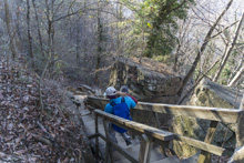
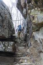
- Description: Leaving the Signal Point overlook at the parking, you descend steeply down large stairs that will pose a problem for some people. Once you get to the bench between rock layers, the hiking is flatter though also exposed. At a half mile, you get to a wonderful overlook which looks towards Edward Point. The trail becomes rockier as you work your way up Middle Creek, before eventually crossing it at mile 1.5. Here, the trail climbs steeply up to the top of the ridge line and you walk along the edge of the bluff with spectacular views, though marred by Alexian Retirement community. Quick enough, at mile 2.9 you get to the first Edward Point Overlook. This one is very nice... but go another tenth of a mile and you get an event better one. There are also a couple unreal camping spots in this quarter mile too. I am stopping this description here as most will either go back to Signal Point, or more likely go back via the Rainbow Trail (which connects at the Middle Creek Bridge) to Ohio Drive. It seemed like that was the most common out and back approach to get to Edward Point.








Edward Point to HWY27
- Stars: ★ ★ ☆
- Access: You can access this through the Signal Point section or if you wanted, the Shackleford Ridge Trailhead for just the Suck Creek section or a loop, or from Ohio Drive Trailhead for a shorter shuttle and less hiking. The trail pops out onto TN-27 at (Location: 35.15294, -85.39512) but there is no parking there. The CTC says there is another outlet half a mile up but we could not find that and could not find a fork to take us there on the trail either, so I think that info is obsolete. Instead, we parked down the road a quarter mile from where the trail hit the hwy at (Location: 35.14942, -85.39253)
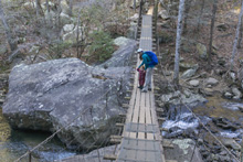
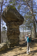
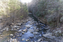
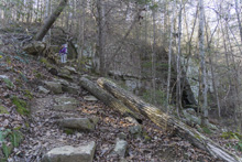
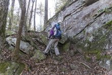
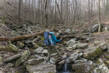
- Description: From Edward Point, the next mile has some wonderful open views of the Tennessee River. Once you round the corner and begin heading up Suck Creek, the views become less obvious and plentiful. There are several small creek crossings that could pose issues after heavy rain. But this part of the trail is the lowlight (opposite of highlight) for the section. Eventually, you get to Mushroom rock. Here, you can head to the Shackleford Ridge Trailhead for a shorter shuttle or a loop hike, or, drop down the downhill side of the Mushroom and steeply descend to the bridge over the North Suck Creek at mile 7.0 from Signal Point. On the other side, you climb steeply to the ridge between North and South Suck Creeks. There is one cool feature here 5 feet off the trail where a small rock arch spans a 50 foot deep sink hole. Once you walk along the ridge for three quarters of a mile, you descend steeply to the crossing of South Suck. Note that in 2021 the bridge here was washed out, requiring rock hoping. Suck Creek is kayakable after most moderate rains in the winter so be mindful that a rain in the past few days may make this crossing impossible to do safely. Luckily, the road is 40 feet on the other side of the crossing, so just scout this out before hiking from the other end if that is your plan.





- Stars: ★ ★ ★
Tennessee River Spurs
- Stars: ★ ★ ☆
- Access: Access is at the main trailhead 3 miles into Prentice Cooper State Forest (Location: 35.13282, -85.41907) on Game Reserve Road. The trail pops out onto TN-27 at (Location: 35.15294, -85.39512) but there is no parking there. The CTC says there is another outlet half a mile up but we could not find that and could not find a fork to take us there on the trail either, so I think that info is obsolete. Instead, we parked down the road a quarter mile from where the trail hit the hwy at (Location: 35.14942, -85.39253)
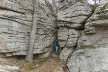
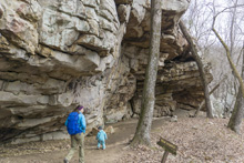
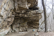
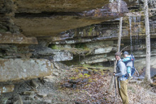
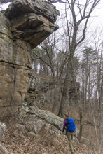
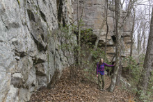
- Description: This hike starts off on a smooth well graded trail that would make an easy walk for most people. You then descend briefly and at 0.5 miles get to the first treat of the day, the Stone Door. Here the trail goes down stairs, between two large rocks, just a few feet apart. Around the corner below, is the Indian Rock House. There is also a fork here. Turning right takes you on the Mullens Loop. Turn left continues on the section described here. The trail continues in the forest for a short ways, but nice rock formations, a small waterfall, and a few easy creek crossings keep you occupied. After a mile, the ridge steepens and you are greeted with pleasant views of the river below and the ridge line on the opposite shore. The only downside is that the trees are dence, and you only get an open view in one clear cut spot. As you round the ridge and begin to head up the Suck Creek valley, you take a small detour further into the ridge to cross a tributary creek. Again, there is a nice bluff line to walk along and nice views of the walls opposite of Suck Creek which form the end of the Signal Point to Hwy27 hike. At mile 3.5 you get to the highlight of the hike, a nice open overlook. From there, it is a nice gradual descent the rest of the way, crossing one more creek before you get alongside the road and have a brief but steep descent to the wood stairs at the highway. Note, that the CTC website says there is a fork and an upper access with a cement parking area. Maybe that was once true, but this is the only outlet of the trail we could find and we saw no fork.










- Stars: I have not hiked this yet
- Access:
- Description:
- Stars: I have not hiked this yet
- Access:
- Description:
Poplar Springs
Mullens Loop
Pots Point Loop
HTML Comment Box is loading comments...
A Wet State - Home Page
