Obed Wild & Scenic River Segment
| Section | Sub-section | Miles | Elevation Gain West to East (ft) |
Elevation Gain East to West (ft) |
GPX File (Right click, save as) | AllTrails Link |
| Obed River | Full Section (Devil's Breakfast Table to Nemos) | 12.1 (reports are it is closer to 15 miles) | 1,980 | 2,106 | Link | Page |
| Devil's Breakfast Table to Obed Junction | 2.5 | 430 | 470 | Link | Page | |
| Obed Junction to Breakaway Bluff | 6.5 | 880 | 920 | Link | Page | |
| Breakaway Bluff to Nemo Bridge | 3.5 | 680 | 990 | Link | Page | |
| Emory River | Full Section Not Complete | - | - | - | - | - |
| Nemo Bridge to Obed Confluence | 1.2 | 240 | 90 | Link | Page |
Obed River: Devil's Breakfast Table to Nemo
- Stars: I have not yet done this section... check back later. But I have kayaked it, and I assume this is a nice section...
- Access : WARNING: The Devil's Breakfast Table is within the Catoosa Wilderness Management Area, which has hunts and rest periods. The rest period is closed to all motorized traffic and occurs from February 1 to the last Friday in March. Foot traffic through hikers are still able to access the trail however. During hunts, wear bright orange fluorescent clothing. Hunting schedule is located here.
- Note: The mileage is based on an AllTrails track, reports are this trail is closer to 15 or even 16 miles. I will update mileage and the track (for the full and partial sections) once I hike it myself.
Obed River: Devil's Breakfast Table to Obed Junction
- Stars: I have not yet done this section... check back later. But I have kayaked it, and I assume this is a nice section... but not as nice as the canyons along the Obed downstream (or upstream along Daddy's Creek in the Devils Breakfast Table section of the Crab Orchard Segment).
- Access:
- Description:
Obed River: Obed Junction to Breakaway Bluff
- Stars: I have not yet done this section... check back later. But I have kayaked it, And this has to be a nice section of canyon to see via trail. I have read that there are a lot of blow downs in this section which can make following the trail difficult at times.
- Access:
- Description:
Obed River: Breakaway Bluff to Nemo
- Stars: I have not yet done this section... check back later. But I have kayaked it, And this has to be a nice section of canyon to see via trail.
- Access:
- Description:
- Stars: I have not yet done this section... check back later. But I have kayaked it, and I assume this is a nice section... but not as nice as the canyons along the Obed downstream (or upstream along Daddy's Creek in the Devils Breakfast Table section of the Crab Orchard Segment).
Emory River: Nemo to Wartburg
- Stars: TBD
Emory River: Nemo to Obed Confluence
- Stars: ★ ★ ★
- Access: To make it a "through hike" from the end of the previous section of trail, use Rock Creek Campground (Location: 36.07075, -84.66438) which then results in a short road walk and old bridge crossing over the Emory to then pop out a quarter mile later in the Nemo Bridge Parking lot. I started at the Nemo Bridge Parking lot and that is where my measurements start from (Location: 36.06906, -84.66126)
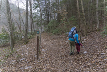
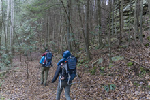
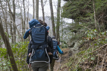
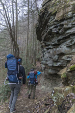
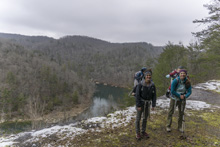
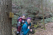
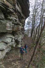
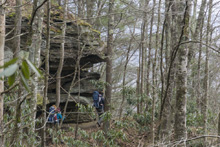
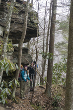
- Description: For being a short section of trail, this section packs a lot of wow! I can't wait for the trail to continue to be built as I have kayaked the Emory River Canyon and know that the bottom few miles of that canyon are also very pretty and I assume the trail will at least peer into that section. As it is, the trail currently only goes 1.1 miles up the Emory from Nemo Bridge to the Obed Confluence. Those are weird rivers in that the Obed is a much bigger river, but I assume due to the history of the train tracks which follow the Emory up river, the section downstream of the confluence takes the name Emory, rather than Obed River. Anyways, as you leave the Nemo parking lot, after 100 ft look for the well marked right turn to begin climbing. Cross a dirt road and continue climbing. Most of the elevation gain is all in this climb. Once at the top, turn left on the double wide trail that quickly turns into single track along the base of a nice bluff line with several outstanding rock features. Eventually you get to a rock bench blasted as I assume in tunnel construction for the train downhill from you. This is an excellant open view of the pool below the confluence. The trail goes another 0.1 miles or so to a picturesque creek crossing which is the current end of the trail section. 1.1 miles each way... but so worth it. We then had a nice picnic at the Nemo day use area.


Emory River: Obed Confluence to Wartburg
- Description: This section of trail does not exist yet. Eventually this will connect to Ross Gap in the Bird Mountain Segment of the Cumberland Trail.
HTML Comment Box is loading comments... - Stars: ★ ★ ★
A Wet State - Home Page
